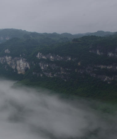
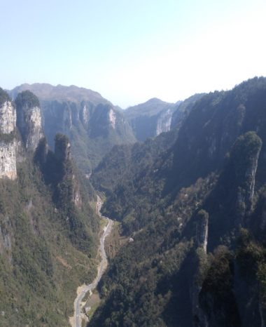
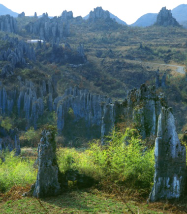
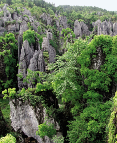
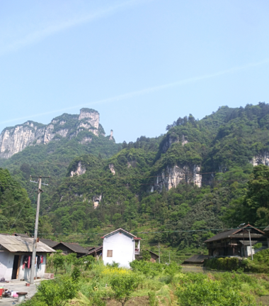
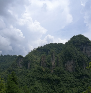
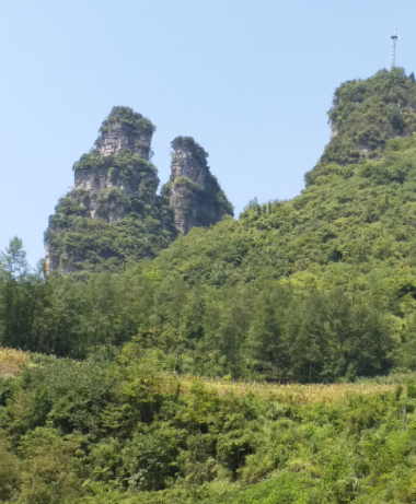
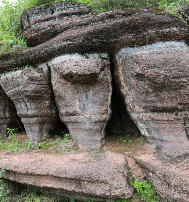
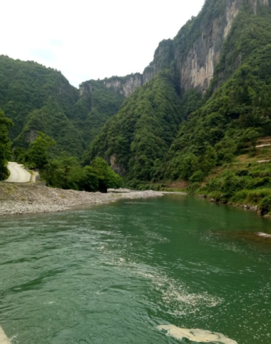
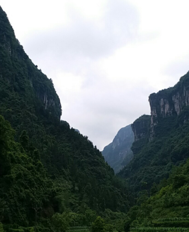
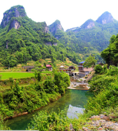
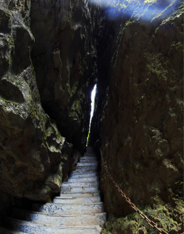
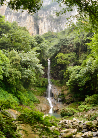
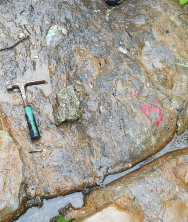
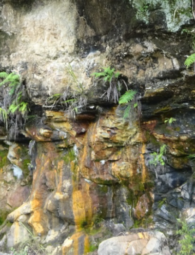
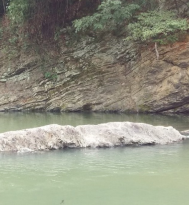
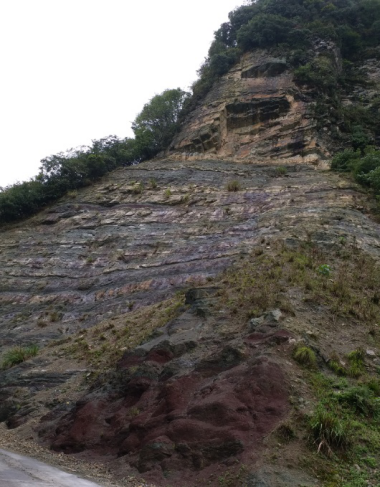
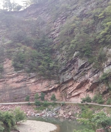
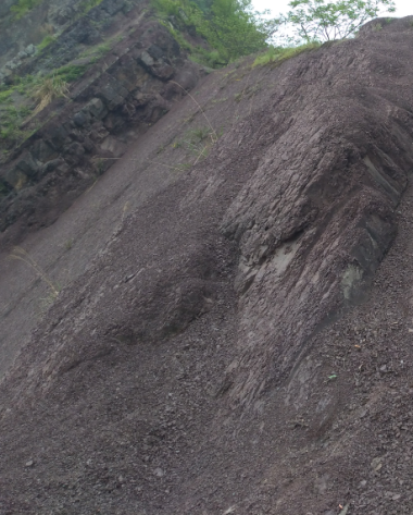
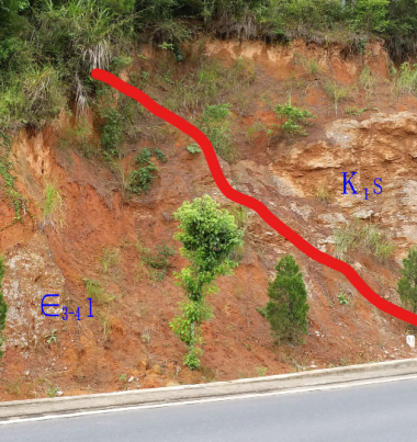
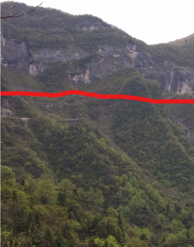
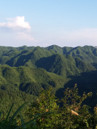
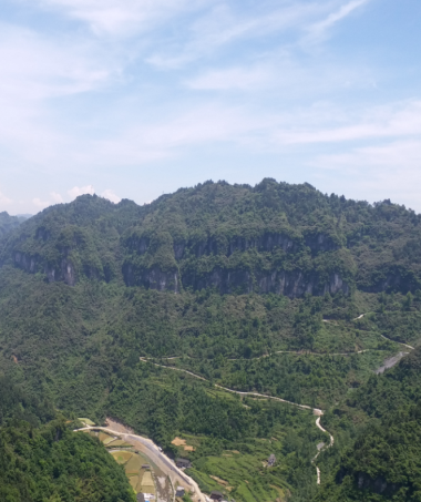
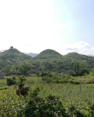
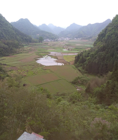
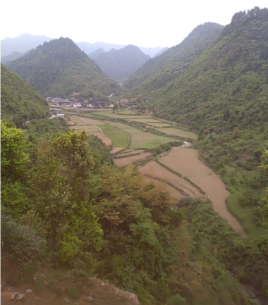
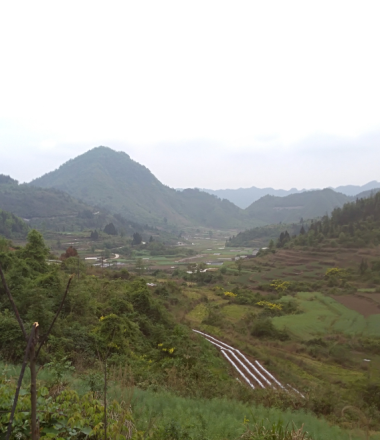
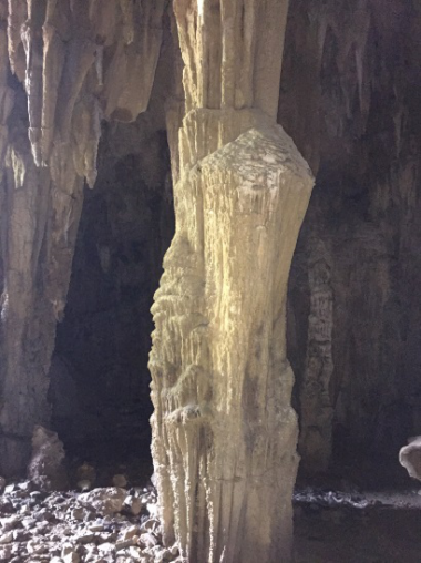
Introduction and Pictures of Geosites in Xiangxi UNESCO Global Geopark
|
No.. |
Name of the relics |
Brief Introduction |
Picture |
|
1 |
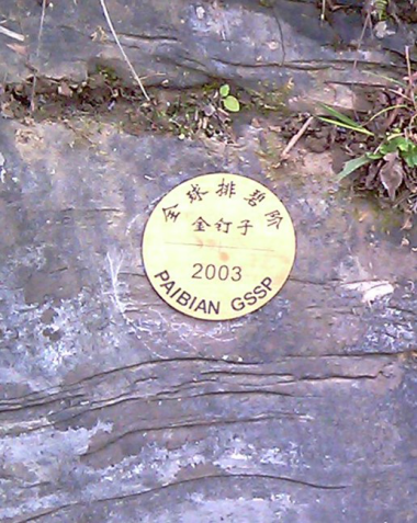
The GSSP at Paibian Stage of Furong Series in the Cambrian System |
The section is about 1.7km long. The GSSPis located at 369.06m above the bottom boundary of the Huaqiao Formation.Lithologically, it is made up of dark gray thin layer of mudstone, gray thin layer of fine-grained limestonemixed with fine gravel limestone lentils. The Huaqiao Formation of the Paibi section has a total thickness of 388.5m and is divided into 39 layers. The lower part of 126m is mainlymade up ofblack-gray thin-middle layered dolomitic, calcareous mudstone, stratified mudstone,mixedwith gray-dark gray thin-medium thick layered powdered limestone; from 126mabovethe bottom occurs a clastic limestone interlayer with debris flow. Generally, there is aninterlayer within a thickness of about 10m. The thickness of the single layerranges from 8-30cm. The interlayer of the gravel and limestone increases gradually,so does the thickness of the single layer.From279.60mabove the bottom, there are usually one to two layers of pebbly limestone interlayer within a few meters of the strata, and the thickness of the single layer of some interlayers can reach more than 1m. The underlyingAoxi Formation is 15.26m thick, and the lower part ismade up oflight gray dolomite with a thickness of 12.96m, while the upper part is made up of the interbedded layer of dolomite and black carbonaceous shale, with a thickness of 2.30m. |
|
|
2 |
The GSSP at Guzhangian Stage of Miaoling Series in the Cambrian System |
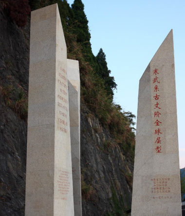
Located in the northwest-southeast slope zone on the southeastern edge of the Yangtze Platform, Luoyixi Section belongs to the paleontological mixed zone transitioning from shallow sea to deep-sea. The gravity flow sedimentation is very developed. The section is made up of marine carbonate rocks and its biological phase is stable, containing highly differented "slope-phase trilobites" mixed with benthic type at the platform and the plankton in the wide sea. Prof. Peng Shanchi with the Chinese Academy of Sciences proposed to use the FAD of trilobites Lejopygelaevigata that is globally distributed to define the bottom boundary of Stage 7 of the Cambrian system (Guzhangian Stage), the GSSP is located at 121.3m above the bottom boundary of the Huaqiao Formation (now the Chefu Formation). |
|
|
3 |
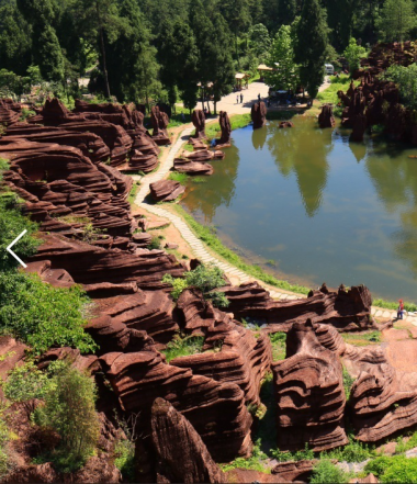
Hualan Red Stone Forest |
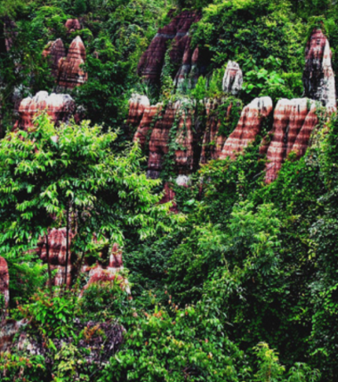
Hualan Red Stone Forest is located in the valley slope on the south bank of the Youshui River Valley, the Shuiyin- Xiangjiazhai synclinal core part. It is developed in the Guniutan Formation (O2-3g), the mid-and-upper Ordovician system. Lithologically, it is made up of purple-red, medium-thick to thick layer nodular, argillaceous limestone, containing bioclastic argillaceous limestone. It is a landscape-forming rock layer of the Red Stone Forest. Hualan Red Stone Forest covers an area of 8.5km2 with “three stages”. From altitudes of 350m to 460m, stone forests with three different altitudes are developed. The stone pillars are tall and dense, looking like high walls or ancient castles in the distance. If we have a closer look, we can see they are in different shapes, primitive yet magnificent. Due to the impacts of surface and subsoil dissolution, stone pillars in different shapes are formed, such as mushroom, tower, cone (teeth), sword, and ancient castle shapes. Each stone column is 5-20 m high. Under the stone forest are distributed karst depressions, underground rivers, karst windows, and springs, etc. These landforms not only show the connection between stone forest development and groundwater, but also combine with other karst landforms to form various karst assemblages.
|
|
|
4 |
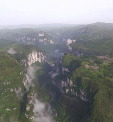
Dehang Grand Canyon |
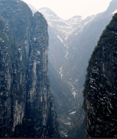
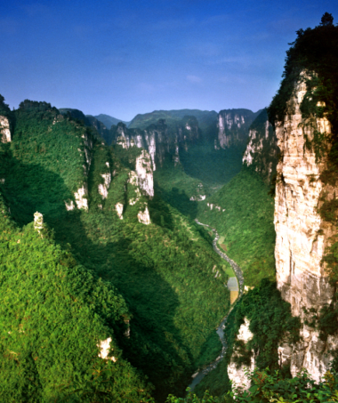
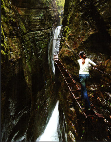
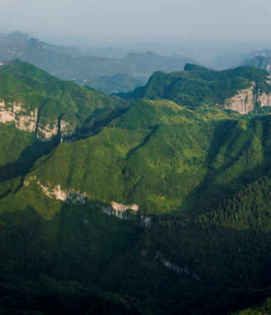
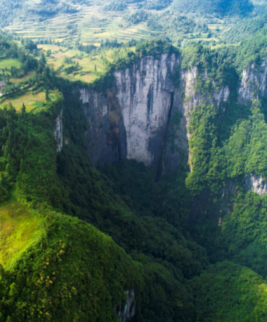
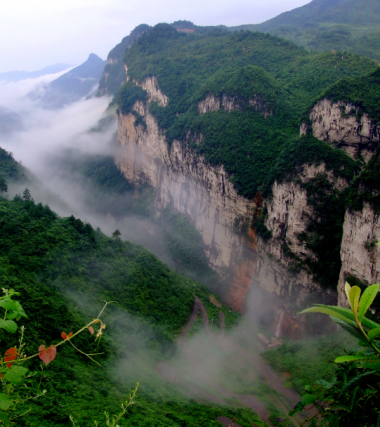
Dehang Canyon Group consists of Xinzhai River Valley, Pailiao Canyon, Jiulongxi Canyon and Yuquanxi Canyon. It is developed in Chefu Formation (Є3-4c), Aoxi Formation (Є3a), and Qingxudong Formation (Є2q). in the Cambrian system. Lithologically, it is made up of gray thin layer – medium and thick layer limestone, argillaceous banded limestone and dolomite mixed with shale. The Xinzhai River Valley is about 4.4km long, with a valley floor width of 50-180m, and a longitudinal slope of 0.007. It has a slope of 35°-55° on both sides of the canyon, and vegetation is developed. The world-famous Azhai Super-large Suspension Bridge is built above the Xinzhai River Valley, and on the southern side is developed the Sisters Rock Pillar group. Pailiao Canyon is about 3.6km long, generally running in a direction of northeast. The valley floor is 100-180m wide. The mountain massifs on both sides of the canyon are steep , with a relative altitude of 200-260m. The Jiulongxi Canyon is about 2.2km long, running in a direction of 306° to the northwest. The valley floor is 80-150m wide. The mountain massifs on both sides of the canyon are steep, with a relative altitude of 160-350m, a drop of about 165m, and a longitudinal slope of 0.075. Mountain rock pillars are developed on both sides of the canyon. Pangu Peak and Yinlian (Silver Chain) Waterfall occur in the area. The Yuquanxi Canyon is about 1.8km long, generally running in the direction of 68° to the northeast. The valley floor is 100-150m wide. The slope of the mountain massifs on both sides of the canyon is 30-50°, with a relative altitude of 100-260m. Tectonically, the Dehang Canyon Group lies on the horst between the regional Malichang Fault and the Guzhang-Jishou Fault. The secondary structures are extremely developed. The rainwater erodes and dissolves along the joints, fissures or fractures. With the uplift of the Earth’s crust, the linear valley becomes deepened. The bedrock on both sides of the cliff collapses towards the free surface due to weathering,, eventually forming the Dehang Canyon Group where rock walls and rock pillars are developed.
|
|
|
5 |
Luota Karst Platform |
Luota Karst Platform is a wide, gentle synclinal platform covering an area of about 82km2, with an altitude of 1,000~1,400m, and a relative altitude of nearly 700m against Luota River Valley. The platform runs in a direction of northeast. Its southwest section is slightly northward, while the northeast section is tilted, and the shaft is made up of Triassic and Permian carbonate rocks, with a thickness of 800-900 m. The two wings are made up of Devonian and Silurian sandstones and shale, which is a water-resistant layer with a thickness of over 2,000m. From the south to the north of Luota synclinal platform, there are three karst sub-platforms that are half-separated, i.e., Ganjiatai (1023.5)-Xiejiatai (1079.2), Wuzuoting (1009.1), Yabusi(1075.0)-Heshangpu (1072.6). The three platforms are incised by a superimposed valley-canyon, with seasonal or intermittent creek water flowing at the bottom. Smooth planation surfaces are formed in different stages due to uplift of the Earth's crust.
|
|
|
6 |
Dahang Rock Wall-Rock Pillar Group |
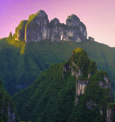
Dehang RockWall-Rock PillarGroupis developed in the Qingxudong Formation (Є2q) , Aoxi Formation (Є3a) and Chefu Formation Formation (Є3-4c)of theCambrian system. Lithologically, it is made up of thin-medium thick layerofgrain and clastic limestone and dolomite. It comprises Tianwen Platform, Sisters Peak,Sima Peak,Zhuiniuzhu Peak,Zhuiniuhuazhu Peak, Pangu Peak,Huaping Peak, TianmenNatural Mural, etc. The rock wall-rock pillars are in various shapes, like sisters, eagle, peacock, etc., which are lifelike and are distributed on both sides of the canyon. The group is mainly controlled by the northeast and northwest faults,extensional joints and fissures. |
|
|
7 |
Luota Stone Forest |
Luota StoneForest is located in Maokou Formation (P2m) ofthe Mid- Permian system.Lithologically, it is made up of a very thick layer of weak dolomitic mudstone containingchert banded limestone. Itis structurallysituated in the northwest wing of LuotaSyncline, with agentle occurrence. The stone forest mainlyoccurson depressions andslopes on both sides of thedepressions. The stone forest is sparsely distributed at the slope top,although the individualsize is large. The stone forestcovers an area of about 2.5km2,with aheightof generally 6~15m,andthehighest one can be more than 20m. The diameter is 4~13m. Individualstone column hasdifferent shapes, such as column,cone, wall, slab, cluster,and castle, etc. Among them, there are six double stone pillars looking like the horns on the sheep head.Hence they are called “SixSheep” Stone Forest. The stone pillars arelifelike,in the shapes ofhumans and objects. Among the most characteristic are theLabyrinth,Elephant’s Soul,ImmortalFinger,Lovers’Rock,Six Gates,Celestial Soldiers,Bulls Greeting Guests,Roosters Heralding the Daybreak,MushroomStoneGate,Rose in Desert,CamelLooking Back, etc.The stone pillars are mainly formed by flowing watererodingalong joints,and fissures. The stone pillars are made up of pure limestone and the lowerbasic parts are composed ofchert banded limestone.
|
|
|
8 |
Shanwan Stone Forest |
The stone forestoccurs on a slope body with a slope of 15-20°, extending in the direction of 130-150°,with an areaof about 2.2 km2. The stone columns are densely distributed, and the single stone column is generally 6-10m high (with the highest one of 20m), and the diameter is 1~7m. The stone columns are of various shapes, such as column, cone, sword, tower, monument, wall, slab-column, screen and cluster, etc.Some look like human beings, while others look like objects, and arelifelike.Looked in the distance, they are likesoldiers in arrays, spectacular and beautiful.Stone teeth less than 5mare distributedin and aroundthe stone forest. The stone forest is located in the west wing of the LuotaSyncline,with flat occurrence. It isdeveloped in the Upper Permian Wujiaping Formation (P3w).Lithologically, it is made up of thick to massive pure limestone and dolomitic limestone.Dissolved poresare developed on the surface of the rock, and joints andfissures arealso developed.Rich Fusulinid and coral fossils can be found in the rock layers. |
|
|
9 |
Xigou Stone Forest |
Thestone forest is located in the Middle Permian Maokou Formation (P2m). Lithologically, it is dominated by thick limestone, whichcontains richFusulinid and coral fossils. The stone forestcovers an area of about 3km2.They are distributed individually or in groups. The stonepillars are of various shapes, such ascone, column, cone, sword, wall,andcurtain, etc. They look likehumanbeings or objects, such asCrocodile Biting,Overturned Boat,ImmortalFinger,Lovers,Killing Demon,Stone Gate. The individualstone column is generally 5~15m high anda small amount of them are more than 15m high. The fissures and jointsare developed inthe Xigou Stone Forest in the Luota synclineshaft area. The fault structure isalsodeveloped, mainlyrunningin the north-east direction and the north-west directions. The stone forest is formed by water flow eroding and dissolving along the joints andfissures. |
|
|
10 |
Kebi Red Stone Forest |
The red stone forest isdeveloped in the Ordovician Dawan Formation (O1-2d) andGuniutan Formation (O2-3g). Lithologically , it is made up of medium-thick layered purple-red mixed with gray-greennodular argillaceous limestone.Covering an area of about 13.9km2, the red stone forest is distributed in a gentle slopeareawith a slope of 15°~25°. It is formed bysubsoil erosion and surfacedifferentialweathering.The three main typesare dissolutiongrooves and fissures, which run in a direction of 287°, 65° and 27°. The stone forests areofvarious shapes,such as flame, tower, sword,andwall, etc. The stone forest occurs around the depressions and slopes.In some areas are developed dissolved pores, and the stone forest is 5-20 m high. |
|
|
11 |
Zuokuba Red Stone Forest |
ZuokubaRedStoneForestis developedin the Ordovician Dawan Formation (O1-2d) andGuniutan Formation (O2-3g).Lithologically, it ismade up ofpurple-rednodular argillaceous limestone, marl and dolomitic limestone. Covering an area of about 10km2,it has an elevationranging from 250m~800m.In general, it is brownish red, oftenmixedwith blue-gray color. In the sunlight,the red stone forest is bright andcolorful.Thestone pillaris of various shapes, such as sword, column or mushroom. They aredistributed inpatches or clusters on top of hills, slopes, troughs, and depressions, showing a rich combination of stone forest landscape. |
|
|
12 |
Liexi Red Stone Forest |
Liexi Red Stone Forest is located in Liexi Village, Liexi Township, Yongshun County, in the Liexi-Zeqiu synclinal core part,andnear the secondary NE-trending fault zone on the south side of the Zhangjiajie-Huayuan (Zhanghua) Fault. It is developed in the lower-Ordovician Dawan Formation (O1-2d). Lithologically, it ismade up ofa purple-red medium thick-thick layerednodular argillaceous limestone containing bioclastic argillaceous limestone. The occurrence is 165 °∠ 7 °.The stone forest isdeveloped on a slopeareawith a slope of about 15°. It covers an area of about 3 km2. Karren isdeveloped in the stone forest, mainly consisting ofthree groupsrunning in a directionof 55 °, 20 ° and 317 °. The individual stone pillars are clustered or sword-shaped, and are 3.5-4 m high. Due to different calcium content,a strong differentialdissolution can be seen. The grooves are generally about 20 cm wide, and the ring-like dissolution phenomenon is commonin the stone forests. It is a large red stone forest area. |
|
|
13 |
Lanhua Cave |
Lanhua Cave isdeveloped in the lower Ordovician system. Lithologically, it is made up of medium-thick layered limestone and dolomitic limestone.At the entrance to the cave is akarst window,which is elliptical, with a sizeof 20×15m2 and a depth of 28m. The cave is about 2.5km deep, which is full of twists and turns. Thespeleothems areofvarious types andshapes, includingstalactites, stoneteeth, stone pillars,soda straw,rimstone dams, stonecurtains and stonepearls.Two layers of calcareous cemented deposits,as well as the deeply-incised “V”-shaped valleys can be foundin the cave, indicating that the cave had experienced at least two uplifting processes. The cave is controlled by fractures, joints and fissures. It isformed by the water erosion anddissolution. Later,due to cave roof and wall collapses, the cave wall collapses, the cave is continuously widened andrises steadily. |
|
|
14 |
Lüdong Mountain |
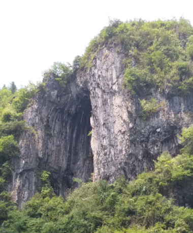
Lüdong Mountain Light through Cave is located at the edge of the DongmakuPlatform.While its lower part ismade up of shale mixed with limestoneinCambrian Shipai Formation (Є1-2s), the upper partconsists of gray-dark gray, thin-medium thick layerpowdered crystalline limestoneinthe Qingxudong Formation (Є2 q). Lüdong Mountain is a rock-wall typed light thorough cave incised by two canyons. The rock wall is located at the top of Mount Agong at an altitude of 1227m. It is 60-70m high and 130-150m long, running in a direction of 300°,and is 4~30m thick.Two light through caves are developed in the mountain, which run in a direction of35°. The largelightthroughcave is about 25m high, 8m wide and 4m deep;whilethe smallone is about 10m high, 5m wide and 4m deep. The twocaves are erected in parallel across the mountain, resembling thesemi-inverted Chinese character "Lü". Thelight through caves are formed due to the erosion, dissolution and incision of early formedkarst caves bynorthwest-running water flow during the later crustal uplift process, and some ofthese caves are left over to form thelight through caves.
|
|
|
15 |
Wangchuanyan light through cave |
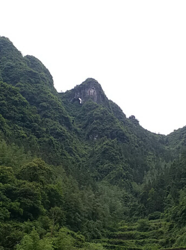
The light through cave is developedin the CambrianBitiao Formation(Є4b). Lithologically, it is made up of thin-medium thick layer of limestone and dolomitic limestone. The light through cave occurs on the rock wallrunning in a direction of north-south, with an elevation of about 600m.It is about 30mhighand 3~8m wide.Looking like a vertical eye, both ends are tipped out, with a depth of 8~10m. Thelight through cave is developed along east-west.Due to uplift of the earth's crust, the original karst cave is uplifted to form a dry hole,while the joints and fissuresthatare developed afterwards along the north-south-north direction are cut off. With the downward erosion of the flowing water and the gravity collapse, alight through cave is formed on the ridge. |
|
|
16 |
Xiangbi(Elephant Trunk)Mountain |
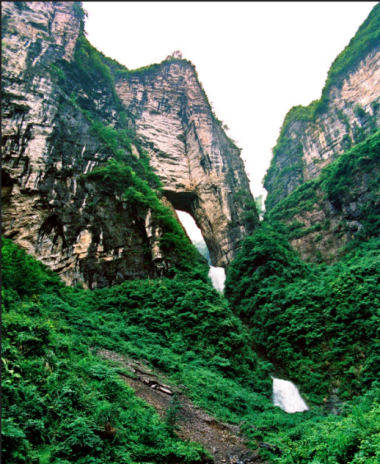
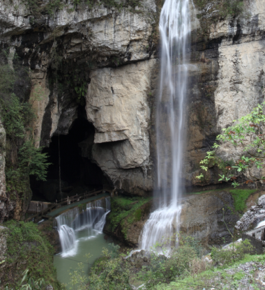
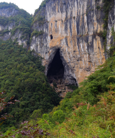
Xiangbi (Elephant Trunk) Mountain Cave isdeveloped in the CambrianChefu Formation ofFurongian Series. Lithologically, it is made up of thin layer of carbon argillaceous limestone anddolomite with near-horizontal occurrence. Along the entrance to the mountain cave is developed anormal faultrunning in the direction ofnortheastern (the TunliangshanFault),some rock mass of the mountain slides and collapses along the fault fracture zoneinto the gorge, and the stream water erodes the fracture of the rock mass to form a faultcollapse-based light through cave. The light throughcave is about 30m high,and 5~20m wide,and 4~6m deep,with the entrance to the cave faces 70° to the north. From a distance, the light through cave isshaped like an elephant trunk. Thereare three stages of waterfall running in the middle of the cave.Therefore, a breathtaking viewis formed. |
|
|
17 |
Lingdong Karst Window Group |
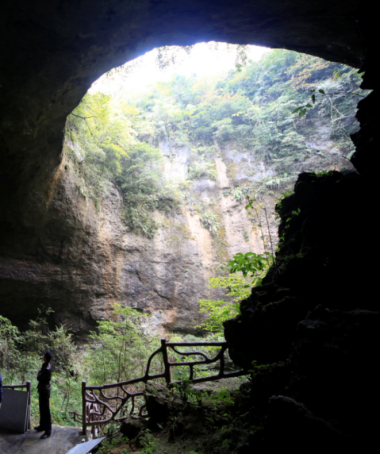
LingdongKarst Window Group is located in the northwest wing of LuotaSyncline.Lithologically, it is made up ofthe Permian limestone.Karst windows areextremely developed.Indeed, fivekarst windows are developed within 240m along the northeast direction. It is akarst window grouparranged in one line group,with a depth of 10-73m and a width of 4-43m. The surroundingareas are steep cliffs. The largest and deepestkarst windowis theone at thesouthside of thenatural bridge.It is 73m deep and has a maximum diameter of 43m.At the bottom of the karst window, the underground river cave is connectedwith the sinkhole. As the karst cave continues to widen, the roof of the cave becomes thinner, loses its support, andeventually collapses to form akarst window. A waterfall runs down the wall of theTiankengpit,while a large karst cave runs through the pit wall,which is a masterpiece of the Mother Nature. |
|
|
18 |
Youshui River Valley |
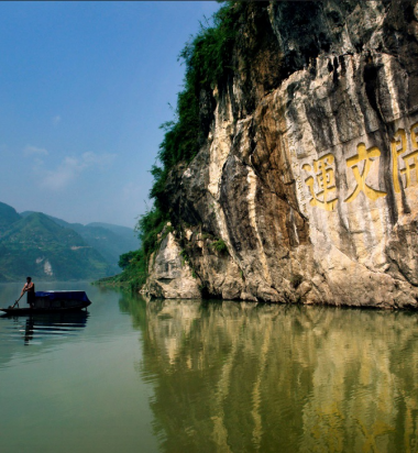
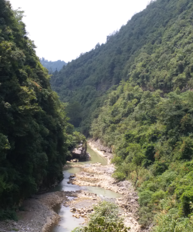
Youshui River belongs to the first-class tributary ofYuanshui,bordering Wushui River in the south, Dalou Mountain and Wujiang River in the west, and the Wuling Mountains andLishui River in the north. In Youshui River Valley are exposedmany secondaryminor faultsrunning in the direction ofnorth-east, north-north-east. The displacement distance is small,which is often several centimeters to several meters.Lithologically, the outcropped rocks in the valley are mainly made up of gray-dark gray thick layer of bright-grained bioclastic limestone, limestone, dolomitic limestonemixed withdolomiteinthe OrdovicianHonghuayuan Formation (O1h) and TongziFormation (O1t), as well as very thick layer of dolomite in the Cambrian Loushanguan Formation (Є3-4l). Thevalleyis about 50km long, 220~620m wide, and 110~520m deep. It is "V" shaped and is distributedalongthe east-west direction. Thevalley is a landformjointly shaped by the erosion, dissolution of rivers and collapse in the karst area. Its formation and development are closely related to various factors, such as rock properties, riverbedhydraulic gradient, andwaterflow. |
|
|
19 |
Donghe River Valley |
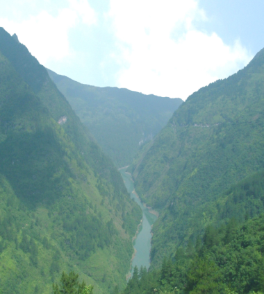
TheDonghe RiverValley is located in the area from Dalong Village, Buchou Township, Huayuan County to Aizhai Town, Jishou City. Itis about 30km long, running in the direction of northeast. Thevalley is 120-430m wide and 100-120m deep. Thefloor of the valley is theDongheRiver,which has a riverbed width of 20-36m, and flowsalong the northeast. Thevalley isdeveloped in the Cambrian Bitiao Formation (Є4b) andChefu Formation (Є3-4c). Lithologically, it is made up of medium-thick layer of dolomitic limestone, limestone and thinlayer ofargillaceousbanded limestone, andargillaceous limestone. The slope of the mountain massifs on both sides of thevalley is generally steepin the upper partsandgentle in the lower parts, andmost ofthe slopes areconverted into farmland andresidential areas.Rock pillars and rock wallsare developedon the cliffs on both sides of thevalley. Thevalley is inmaturity. Rainwatererodes and dissolvesalong the joints and fissures or fractures, and the basement rocks on both sides of the cliff wall collapse towards the free surface to form theriver valley. |
|
|
20 |
Tianxing Mountain Valley |
The valleyisdeveloped in the CambrianChefu Formation (Є3-4c) andBitiao Formation (Є4b).Lithologically, itis mainly made up of thin-thick layered dolomitic limestone, argillaceous limestone, and argillaceous dolomite,with a flat and gentle occurrence. Thevalley is "U"- shaped, 3.1km long, extending southeast in a direction of 120°, thevalley floor is 50-200m wide,whilethe valley shoulder is 100-500m wide, with adepthof 150-300m. The mountain massifs on both sides of thevalley are steep, and the waterfallspour down the cliffs. Karst hills and depressions are developed on the platform. The valleylooks magnificent and beautiful.Tianxing Mountain Valleylies on the horst between Malichang Fault and the Guzhang-Jishou Fault. Flowingwatererodes and dissolvesalong the joints and fissures or fractures, and the basement rocks on both sides of the cliff wall collapse towards the free surface to form themountain valley. |
|
|
21 |
Sanmendong Valley |
The valley is developedin the CambrianBitiao Formation (Є4b). Lithologically, it is made up of medium-thick layer ofdolomitic limestone and limestone. Thevalley is 7.8km long. It windsfrom near north-south to 120° northwest, before iteventuallyturns to near east-west direction.It has a valley shoulder widthof 200-400m, valley floor width of 60-200m, anda depthof 100-300m. The cliffs in the valley are steep. It is “U”-shaped,dolines and sinkholes are developedonplatforms onboth sides of the valley. The valley isoften shrouded with mist, deep and serene, and the vegetation is developed. SanmendongValley area lies on the horst between Malichang Fault and the Guzhang-Jishou Fault. Flowingwatererodes and dissolvesalong the joints and fissures or fractures, and the basement rocks on both sides of the cliff wall collapse towards the free surface to form the valley. |
|
|
22 |
Mengdong River Valley |
Mengdong River is the first-class tributary of theYoushui River. Lithologically, the exposedrocks are mainlymade up of the gray thick layer of crystalline limestone, the dolomitic limestoneinOrdovician Tongzi Formation (O1t) and Honghuayuan Formation (O1h),as well as gray-white, very thick-block dolomite in the Cambrian Loushanguan Formation. (Є3-4l). The valley extendsin a direction ofnearly north-south, and is about 42km long from Yongshun Countytothe intersection of Youshui River. There are many cliffs in thevalley,whose height is generally 150-200m,andthe highest is more than 400m. The valley is "U"-shaped, with many caves, waterfalls and stalactites along theriver bank. Thelargest waterfallismore than 80 metershigh, with an overflow widthof more than 10 meters.Peak clusters and strange rocksare developedon both sides of thevalley, mainly including theGoddessPeak, Meeting Peak,Menglang Peak, LotusRock, andGeneralRock.
|
|
|
23 |
Jinlong Grand Canyon |
TheJinlong Grand Canyon is exposed on the CambrianAoxi Formation (Є3a) and Chefu Formation (Є3-4c).Lithologically, it is made up of thin-medium thick layer ofdolomitic limestone, dolomite and argillaceous limestone, and argillaceous dolomite, with aflat occurrence. The canyonextends in a direction of 50° northeast.It isabout 5.2km long, 20-150m wide at thefloor, 300-700m wide at the shoulder, and 200-400m deep. The canyon isgenerallydeveloped along a set of vertical joints and fissures in the northeast-southwest direction. Many suspendedwaterfalls and rock walls-rock pillarsare distributedon both sides of the canyon. The canyon is deep and serene, with green and white stiffs,lookinglike a landscape painting. |
|
|
24 |
Zuolong Valley |
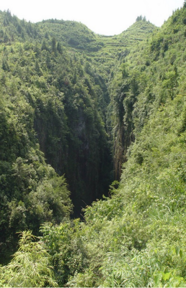
Zuolong Valley is developed in the CambrianChefu Formation (Є3-4c) andBitiao Formation (Є4b).Lithologically, it is made up of gray thin-thick layer of powderedcrystallinelimestone, dolomitic limestone, and argillaceous banded limestone. Thevalley is generally developed along thevertical structural fissures running in the northwest direction.Itis 6.5km long,with an average depthof 80m. Themaximum depth can reach more than 100m. With anaverage width of 3-5m, the narrowest part can onlyallowone person to pass through. Thevalley is linear, and the cliffs are towering. Itlooks like a huge earth slit.Deep and unmeasurable, itwinds through the area like a huge dragon, hence itis named Zuolong Valley, literally meaning Sitting DragonValley. The water at thevalley floor runs rapid, so it is a typical landform eroded by flowing headwater. |
|
|
25 |
Dalongdong Suspended Waterfall |
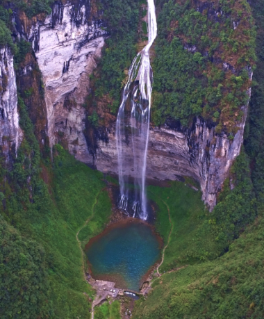
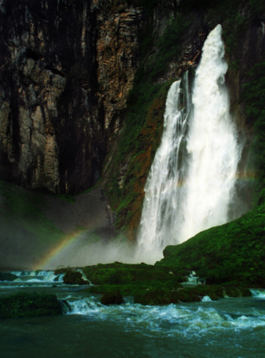
Lithologically, the entrance toDalongdongCave is developed onmedium-thick layer of powder crystalline limestone in the Upper CambrianBitiao Formation (Є4b),while the bottom ofDonglongdong Waterfall isdeveloped onthe thin layer ofargillaceous banded limestoneintheUpper andMiddle CambrianChefu Formation (Є3-4c),with a flat and gentle occurrence. Twogroups of dissolution fissuresare developed on the cliff walls at theentrance to DalongdongCave, running in the direction of135° and 205° respectively. The waterfall has a drop of about 208m. Itsbottom is awater pool, which is about 46.8m long, 23.6m wide, and 6-10m deep. The waterfall has a flow rate of 0.45-105m3/s during the flood peak period.Itswater source comes fromHuoyan (Flame) Caveof YayouTown.The water flows into the underground throughXiaoshuituo,Liubo Township of Fenghuang County, andconverges with the groundwater of the Miliang Leigong Cavebefore it pours down from theentrance to the cave, and eventuallyflows into Donghe River, offering a magnificent view.Thelayer of argillaceous bandedlimestonein Chefu Formation atthe lowerpart is a relatively water-resistantlayer,with poorwater permeability. When the surface water seeps into the ground, itis blocked by water-resistant layer and thenmoves horizontally,before it is exposedat the cliff wall to form suspended waterfall.
|
|
|
26 |
Furong Town Cascaded Waterfall |
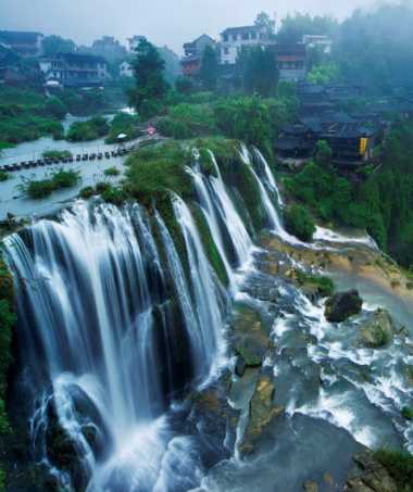
Furong Town Cascaded Waterfall is located near the intersection of YanluoStreamandYoushui River, in the corescenicarea of Furong Ancient Town, andthe southeast wing of the Shuiyin-Xiangjiazhai Syncline.Due to the impact of structural movement, some parts of the waterfall have slight folds.Structuralfissures running in the direction of 40° and295° aredeveloped.Lithologically,the waterfall isexposed on medium-thick layered bright-grained sandy limestone and gray dolomite in the Bitiao Formation (Є4b),while its lower part is exposed on thin layer of powdered crystalline limestone and argillaceous limestone. The waterfall is divided into twostages,with a distanceof 23m between the twostages. The firststage has a drop of 20m and an averageoverflow width of 50m, while the second stageis divided into three sections with a drop of about 33m and an average overflowwidthof 60m. During the flood season, the waterfall has a large amount of water and the overflow width can reachup to70m. The lower part of the waterfall was originally a karst cave. Later, due to the collapse of the roof of the cave and the erosion of the northwestwardfissures, a steep ridgewas formed, and the riverwater poured down to formthe waterfall. Apart frommany cave collapsed deposits, somestalactites still remain below the steep ridge. |
|
|
27 |
Paoshui Valley Cascaded Waterfall |
Paoshui Valley Cascaded Waterfall is developed onthe Cambrian Chefu Formation (Є3-4c). Lithologically, the rocks are made up of thin-middle-layer of argillaceousbandedlimestone, with a flat and gentle occurrence. The waterfall is divided into four cascades, with an overflow width of 2~10m,anda drop of 30~70m for each cascade,(a total drop of about 160m) and a flow of 0.4~2m3/s. Running in the direction of west-east,the water flowsfrom Xinwan Village throughTunliang Mountain to Xiangbi (Elephant’s Trunk) Mountain,before it finallyflows into Paoshui Valley.Due to the impact ofstructural movement, vertical joints and fissuresare developed on the bedrocks.The headwatererosion of flowing water has resulted in the cliff collapse andretreat toform acascaded waterfall. |
|
|
28 |
Zhihuan (Finger Ring) Waterfall |
The waterfall isexposedon thelayer of the Cambrian Qingxudong Formation (Є2 q). Lithologically, the rocks are made up of gray-dark gray thin-thick layer of powderedcrystallinelimestone.Fault is developedat the outcrop, and is accompanied by folds. Thewaterfall has a drop of 15m and anoverflow width of1-2m. There is awaterpool at the bottom, which is about 20m long,and8-12m wide,with a flow rateof 62.02-3000L/s. The water source of the waterfall comes from the streams in the southwest. Thewaterfall is divided into three stages. Thefirst stage isTuofeng (Camel’s Hump) Waterfall, which is located in the northwest. The second stageislocatedabove Zhihuan Waterfall, with a drop of 23m. By merging the underground river, itforms the thirdstage of waterfall (Zhihuan Waterfall). At the bottom is a deep pool. The huge stones in the waterfall are eroded and dissolved by flowing waterto formring-shaped holes, hencethe waterfall is named Zhihuan (literally meaning Finger Ring) Waterfall. The view of the waterfall during the rainy season is more spectacular.Zhihuan Waterfall is a groundwater discharge outlet of Shuanglong Platform. When the groundwater moves downwards, it is blocked by the carbonate rocks of the Qingxudong Formation and the shales or marls in Shipai Formation, then it moves horizontally, before itis exposed in thevalley to from a suspendedwaterfall. |
|
|
29 |
Tuofeng (Camel Hump) Waterfall |
The waterfall, located at the southwestern end of the northwesternvalley, is exposedon thestrataof the CambrianAoxi Formation (Є3a). Lithologically, the rocks are made up of middle layer ofpowered crystalline limestone. The waterfallis divided into two stages, with an averageoverflow widthof 10-20m. The first and second stages have a dropof 5m and 22m respectively. Atthebottom of the waterfall is a rectangular water pool,which is 14m long, and 4~6m wide,with a flow rateof127.513l/s. During the rainy season, the flow rate canreach up to 1 to 2m3/s, offering a spectacular view. About 80m south of thewaterfall is a rock pillar, which is about 70m highwith a diameter of40m.The rock pillar is shaped like a camel hump,hence the waterfall iscalledTuofeng (literally meaning Camel Hump) Waterfall. Its source is theoutlet of anunderground river. The water moves along the valley toform a waterfall with the steep ridge. |
|
|
30 |
Liusha (Flowing Yarn) Waterfall |
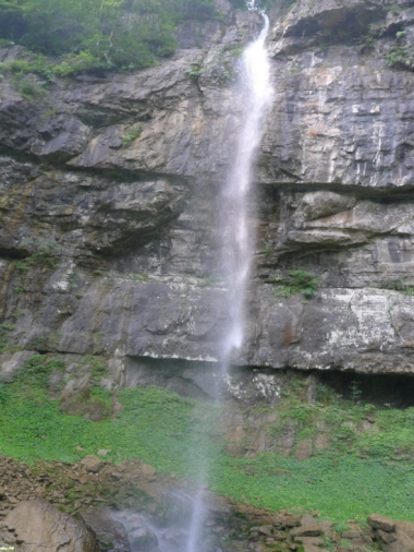
Liusha Waterfall, located at the sourceareaof JiulongxiValley, is exposedon the layer of the Cambrian Chefu Formation(Є3-4c).Lithologically, the rocks are made up ofdark gray thin-medium thick layer of argillaceous banded limestone and sandy dolomitic limestone and carbonaceous argillaceous limestone. The waterfallhas a drop of90m and anoverflow widthof 10~15m.At the bottomis a round water poolcalled Jiulong Pool, which hasa diameter of about 50m and a water depth of 2~4m. During the flood season, the waterfalls pour down from the cliffs and look extremely spectacular. During the dry season, the stream floats down like aflowing yarn, looking graceful and striking. Hence, the waterfall is named Liusha (literally meaning flowing yarn) Waterfall. |
|
|
31 |
Jianduoduo Waterfall |
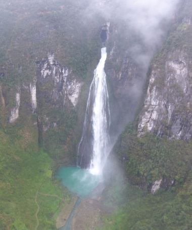
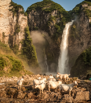
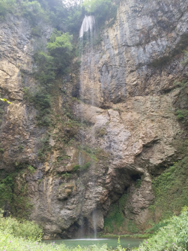
Jianduoduo Waterfall isdeveloped on the strata in the Upper and Middle- Cambrian Chefu Formation(Є3-4c),Lithologically, the rocks are made up of thin-thick layer of gray-black limestone. The waterfallhas a drop ofas high as 236m,and an overflow widthof 1-4m. It is a seasonal waterfall, whose flowranges from 0.27m3/s in dry season to 50m3/s during the flood season.Below the waterfall is a water pool with a water depth of 1-8m and a pool area of about 120m2. The water is crystal clear, and flows fast, with a large potential energy. Itpours down from the overflow hole into the deep pool below,with a roaring sound and great momentum,before it flows into the Niujiao River. |
|
|
32 |
Zhangjiajie-Huayuan Deep and Large Fracture |
The section generally inclines towards the southeast, with a dip angle of up to 70-80°.Compression zoneand fault breccia are developed.Mylonitecanoftenbeseen along thefacture zone. The original rockof dolomite was strongly squeezed and ground into mylonitic rock.The rocks are strongly foliated, and fracture cleavage is developed.The mylonite belt is generally 10 to 25 m wide, and the width can reach up to50 m.A foliatedand fragmentedzone has been formed on the rocks on both sides of the mylonite,which is interspersed by calcites in large quantities. The rocks areobviously subject to silicification and fading processes. The fragmentedzone is generally 10 to 20 m wide,while someareascan be as wide as 400 m.Folds thatrun parallelwithfracture often remain in the fracture zone.Near the Yuzejia LakeHighway, horizontal scrachescan still be seenon the section, indicating the fracture has experienced a right translation apart fromcompressive reverse thrust. |
|
|
33 |
Mengxi River Fracture |
The fault zone is about 16.8km long,running in a direction of north-northeast, which isroughly the same as Luota syncline axis. The northwestern part of the fault is a continuous karst cliff, which ismade up ofvery thick layer of Permian limestone, with a flat and gentle occurrence. Structural traces such as scratches, steps and secondary faults can be found on the cliffs. Affected by thetraction ofMengxi River fault, the rock stratum has slight folds. The Permian and Silurian strata are exposed on the southeastern side of the fault,with an occurrence of283°∠37°. Occurrence of the rock strataat two sides ofthe faultdiffers greatly.Due to the impact offaults, the flowing water continuously erodes and dissolves along the weak surface of the structure, and thencombines withcollapse in the later stage to form the current Mengxi RiverValley. |
|
|
34 |
Trilobite Fossil Group in the Ordovician Period in Liexi |
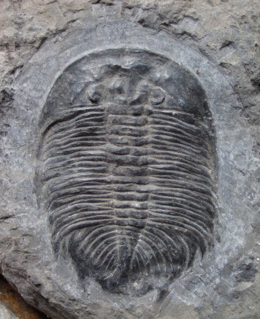
The trilobite fossilgroup in the Ordovician Period in Liexiis located in Longxi Village, Liexi Township, Yongshun County. The fossil is produced in the upperpart of the lower-Ordovician Tongzi Formation (O1t).The rocks are made up of a set of gray-black thin layer of argillaceous limestone and marl. The rocks are rich in fossil layersofabout 15m thick. The relics are rich in fossil reserves, mainly trilobites, such asunidentified species of Xiangxiia, XiangxiiaYongshunensis, Paraszechuanella, etc. The fossils are large and thesize of thelargestoneis 32×28cm2, which isstillpreserved intact. XiangxiiaYongshunensisis a new species found in this layer.Meanwhile,a large number of hornstones are produced. The individualsizeis also very large,andthe largest one can reach more than 1 meter long.They are mainly unidentified species ofLituites. The trilobite fossils produced in this area are preservedwith the remains of trilobites, and arebody fossils. Their livingbodieslived about 460 million years ago.What we see today isonly thehardenite of the trilobiteremains (such as bones). Although the original form is preserved,itssubstance has been replaced or filled with calcium carbonate. |
|
|
35 |
Insect Trace Fossil Relics in the Devonian Period in Purong Town |
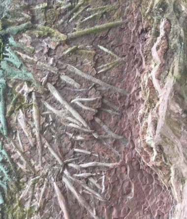
The fossilrelicsis locatedbesides No.015 County Roadof Baojing County, and in the wing of Wanpingsyncline. The fossil isdeveloped in the Devonian Yuntaiguan Formation (D2yt) stratum with anoutcrop area of about 30 m2.Lithologically, the stratum is made up of quartz sandstone mixed with mudstone.The fossil monomeris20-100cm long,with a diameter of4-8cm. It occursin the muddy interlayer with a thickness of 30cm,andis a sandy tubular body. It is inferred to be an insect trace fossil.,which is criss-crossed like aroot, with a high distribution density. |
|
|
36 |
Trilobite Fossil Group in the Silurian Period in Purong Town |
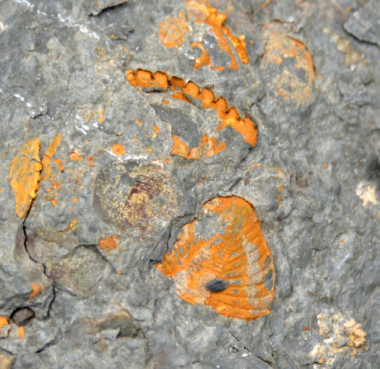
The fossil group is located in the Silurian Wujiayuan Formation (S1w). Lithologically, it is made up of gray-green thin-middlelayer ofsiltstone and fine sandstonemixed withshale.It has a wide variety of fossils,such as trilobites, cephalopods, brachiopods, bivalves and Crinoidea, etc.They aredensely distributed,with anindividual size of 0.5 ~ 3cm. Thefossils are kept intact, the head, chest and tail areclearlyvisible. The glabellar is curved like a bow, the two bows are twice as large as the body, and the two bows arethinenough to beintegrated intoone. This layercorresponds to the famous Xiushan fauna. |
|
|
37 |
Hangsha Giant Sleeping Buddha |
Located in the southeastern wing of the Paibisyncline,the Giant Sleeping Buddha is exposedon thestrataofthe CambrianAoxi Formation (Є3a) and Chefu Formation (Є3-4c).Lithologically, the rocks are made up of thin-medium thick layered dolomitic limestone, dolomite and argillaceous limestone,andargillaceous dolomite,with a flat andgentle occurrence. The long axis of the platformruns in a direction of50° to the northeast,with a lengthof1.25km; whilethe short axis is 0.5km long, and the cliffs at the edge of the platform are150-250m high.Karst depressions and sinkholes are developed on the platform surface. The edge of the platform isincised into fragments due to the impact of Malichangfracture. At the edge of the platformare scattered rock walls and rock pillars,which extend northeastward along the JinlongValley.In the early stages, the platform was subject to the impact of flowing water dissolution and erosion.In the later stages, the basement rocks collapsed along the joints and fissures at a high angle or the fracture collapsed towards the inner side of the valley, forming the landforms in which platforms alternate with valleys.
|
|
|
38 |
Pingnian Rock Wall-Rock Pillar Group |
Structurally,PingnianRockWall- RockPillar Group is locatedon the northwest plate of Bake-XintianFault, and isdeveloped in the Cambrian Qingxudong Formation (Є2q).Lithologically, it is made up of thin-medium thick layered dolomitic limestone, limestone and calcite dolomite.The rock walls, running in a direction of 55° northeast,are100-150m long, 40-70m high, and 5-20m thick.They look like a peacock spreading its feathers.Most of the rock pillars are cylinder-shaped, with a diameter of 2 to 5 m and a height of 5 to 20 m. They are sporadically distributed at the end of the rock walls and at the foot of the slopes. Under the influence of structural movement, two sets of vertical joints and fissures aremainlydeveloped in the area,with a strike of 55° and 327° respectively. Due to the impact of dissolution of flowing water, weathering and erosionin the laterstages, the fractured bedrocks collapse towards the free surface, eventually forming the rock wall-rock pillar group. |
|
|
39 |
Rulai fozhang(Buddha’s Palm)Rock Pillar |
The Rock Pillaris developed in the CambrianAoxi Formation (Є3a). Lithologically, it is made up of gray,thin-middle layer ofstratified powdered crystalline limestone and dolomite. Different sets of faults meet to form a fractured section, and the large jointsurfaces are separated and collapse to eventually form rock pillars andvalleys.Shibadong RockPillar Group is shaped like "ThrreeIncenses" and "Buddha’s Palm".Three rock pillars, which aredeveloped in the upper and middle parts of the slope, are arranged in parallel. The longestrockpillar is about 50m long,whilethe other two are 35-40m long,with a diameterof 5-10m. |
|
|
40 |
Luota Sisters Peak |
Therock pillar group of Sisters Peak stands on the southern edge of the Yabusi Platform.It looks like two people whocling to each other, telling an ancient mythologyabout two lovers.The pillar group is developed in the Triassic Daye Formation (T1d). Lithologically, it is made up of gray-black thin layeroflimestone. Structurally, it is located in the Luota syncline core part. The rock pillar is 80-100m high and isroughly tower-shaped. It is a mountain peak thatremains after thedissolution and erosion of surface water and rainwater along the two groups of fissuresin thenorthwest and northeast. It is a delight to watch this landscape. |
|
|
41 |
Yayou Red Karst Hill Group |
Yayou Red Karst Hill Group occurs inthe area of Huanggua Mountain, Laoren Mountain and Longkou Mountain. It is located in thesynclinal corepartof the Laoren Mountain-La’er Mountain and the northwest side of the Malichang fault zone, with an elevationofover 920m andan areaof about 6.5km2. The red karsthillisdeveloped in the Ordovician Dawan Formation (O1-2d),. Lithologically ,it is made up of purple-red medium thick-thick layer of nodular argillaceous limestone containing bioclastic argillaceous limestone. The individualkarst hills are large in size andareshaped like steam buns. In the process of weathering and dissolution, the rock layerscontaining calcium are mostly dissolved,while thewater-resistant layercontaining more muddysedimentsis difficult to be dissolved and retains. This has resulted in obvious stratification,thus forming karst hill landscape with large size and various shapes.
|
|
|
42 |
Duishan Red Karst Hill Group |
Thegeo-site is located in the dissolved low-hill zone on the eastern side of the Zhailu River. Its surface ismade up ofthe thick-layer of nodular argillaceous limestone inthe Ordovician Dawan Formation (O1-2d). The redkarst hill is similar to theYahou Red Karst Hill. It is scatteredin different shapes, such as dish, steamed bun or lamination. The relative height of thekarst hills is 0.5-2 m. They are surrounded by high coverage ofvegetation.Dolines are densely distributed in the area,totaling 48dolines.On the surface, the dolines are generally elliptical and extend in the northwest or northeast direction. Their long axis is obviously controlled by the tectonic fissuresrunning in the direction ofnortheast and northwest. They are generally60×40m2, and the depth rangesfrom30~100m. The largest one can reach 1.25×10⁴m2.
|
|
|
43 |
Tian’egong (Swan Palace) Cave |
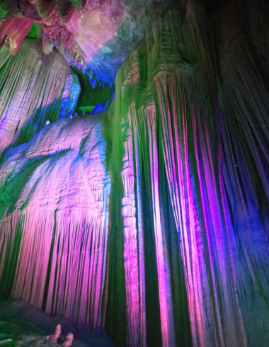
Tian’egong (Swan Palace) Cave is controlled by a northeastward fault, and developed in the Ordovician Tongzi Formation (O1t).Lithologically, it is made up of gray-light gray thick layeroflimestone and dolomitic limestonemixed with dolomite. The entrance to the cave is about 20m above the water surface, and isarched. It is about 20m high and 22m wide. The front section of the cave is a water pool, which is about 100m long. Visitors can only enter the cave by boat. Thewholecave isestimated to bemore than 10km long,with a proved length of 2000m. The underground river in the cave is full of twists and turns,with flowing water.The cave is very rich in stalactites. There are three differentstages of landscape in front of the pool. The first stage is an underground riverchannelwith a length of more than 100 meters, on two sides ofwhich aredistributedstalactites of various shapes. The secondstageis adry cave, which is called a stone corridor. It is more than 200 meters long andspeleothems are developed, such as stalagmite, stone pillar, stonecurtain, stone flower, stonepearl stone forest,andstone waterfall, etc. The thirdstage is thecave chamber,which is200m long, 20-50m wide,in which anunderground riverflows in different width.The cavechamber is full of stalactites, stone flowers, stalagmites, stone pillars, stonepearls, stonecurtains, stone waterfalls, stone pit ridges, stone fields, etc. In the cave is developed awaterfall, which has a drop of about 25m and a width of 5m.Under the waterfallthere is a lake, in which many strange stalagmitesare grown. As these stalagmites looklike a swan dancing,the cave is namedTian’egong (literally meaningSwan Palace) Cave, which is formed under the long-term dissolution of groundwater.
|
|
|
44 |
Yelang Shibadong Cave |
YelangShibadong Cave isdeveloped in the CambrianAoxi Formation (Є3a).Lithologically, it is made up of thin layer of powderedcrystallinedolomite and dolomitic limestone mixed with dolomitic shale.At the entrance tothe cave are developed geological structures, with small faults and folds. Theentrance to the cave is 15~18m high, and6~8m wide. The karst cave is developed in the east-west direction, extending for about 2300m. Thecavityhas a maximum height of 40m and a maximum width of 60-80m. The dropbetween theentrance and the exit of the cave is nearly 35m.In the cave there are speleothems of various types, such as stalactite, stalagmite,rimstone dam, stone pillar, stone flower, stonepearl, stonecurtain, etc. Thecave is generally developed along a tensile fault thatroughlyrunsin a direction of east. |
|
|
45 |
Tiandong Natural Bridge |
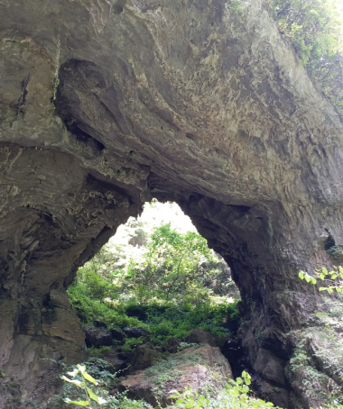
TiandongNatural Bridge is developed in the CambrianAoxi Formation (Є3a). Lithologically, it is made up of layered powdered crystalline dolomite and limestone. The natural bridgehas aspan of about 30m, and a heightof 24m. Its vault is 6~8m thick, and the bridge deck is about 20m wide, facing SE120°. The bottom of the natural bridge is filled with clay deposits. Controlled by the joints and fissures and rock strata in the southeastdirection,flowingwaterdissolves and erodes to form a karst cave extending in the direction of southeast. Later, the roof of the cave collapses due to theearthcrustal uplift, and some parts of the cave remain in the original place, forming a natural bridge. |
|
|
46 |
Guidong Natural Bridge |
Guidong (Ghost Cave) Natural Bridgelies in the near-source area ofShibadong Valley in Paibi Township (now Shuanglong Town).It is developed inthe Cambrian Qingxudong Formation (Є2q). Lithologically, it is mainlymade up ofthin-medium thick layer of limestone. The arch ofthe natural bridge is 12~20m high, with a spanof15~40m,a widthof 20~40m,and a thicknessof 10~20m, facing SE350°.The arch hole changes from large to small. Due tothe impact of structure,undulatingfoldsare developedin the cave. The natural bridge is formed under the joint action of groundwater dissolution, erosion and collapse of cave rock mass. |
|
|
47 |
Jipoling Natural Bridge |
JipolingNatural Bridgelies at the south side of JipolingValley in Jipoling Village, Shuanglong Town (formerly Dongmaku Township), Huayuan County.It is developed in the CambrianAoxi Formation (Є3a). Lithologically, itismade up ofthin,medium-thick layer of dolomitic limestone.Thenatural bridge’s arch is 45-55m high,and20~26m wide,with a spanof 8~15m, and top thickness ofabout 16m. The arch hole is shaped like "∩" , which is located at the edge of thevalley.The natural bridge is formed under the action of long-term dissolution and erosionof flowing waterand collapse of rock mass gravity. |
|
|
48 |
Luota LongTiankeng |
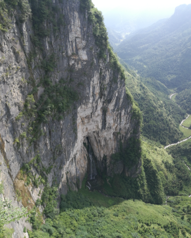
Long Tiankeng isdeveloped in the Middle Permian Maokou Formation (P2m). Lithologically, it is made up of thick layer of limestone and dolomitic limestone. The Tiankeng is 111m deep, 42m wide and 241m long. It is formed by karst collapse. The cliffs are erected around theTiankeng. Its long axisruns in a direction of 90°~270°.Two cavesare developedon the north side of the cliffs. The caveon thewest side is 31m high, 3.2m wide and 15m deep, while thecave on the east is 46m high and 4.5m wide, and gradually narrows from the outside to the inside. The tiankeng issituated at the intersection of two faults,whin run in a direction of55° and 90°respectively. Obvious faults and scratches arevisible on the cliffs, and waterfall landscapecan be seen onthe northern side of the cliffs during the rainy season. The floor of Long Tiankengis connected to the underground caves, which istoo deep to be measured. Due to the impact ofdissolution of groundwater, the undergroundpart becomeshollowtoform akarstcave. When thecaveroof loses its support, it will collapse and form a tiankeng. |
|
|
49 |
Gaoyanhe Canyon |
Gaoyanhe Canyon extends from Huangyan Village of Shuanglong Town to the intersection of Xiaolongdong River andDonghe River. With a length of about 7.6km, the valley runs in an overall direction of near north-south . The bottom of the valley is 50-230m wide, and themountain massifs on both sides are steep and 180-260m deep. The canyon is in a "V" shape.Thevalley is developed inCambrianBitiao Formation (Є4b), ChefuFormation (Є3-4c), andAoxiFormation (Є3a).Lithologically, it is made up of medium-thick layer of limestone, thin layer ofargillaceous banded limestone, thin-middlethick layer of dolomite. The terrain at the bottom of thevalley is relatively flat,where farmlands and villages are distributed.In the valley is developed Xiaolongdong River,which has a riverbedwidth of 15-40m,andflows northsouthward into theDonghe River.Karst landscapes, such asisolated peaks, peak clusters and rock pillarsoccuralong the valley. Individual rock columnsare 15 to 60 m high and vary in shape. |
|
|
50 |
Shibadong Canyon |
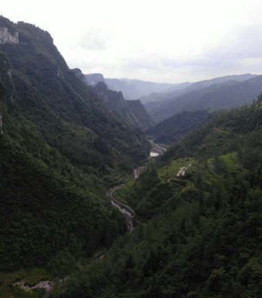
Shibadong Canyon is developedin the CambrianAoxi Formation (Є3a), Qingxudong Formation (Є2q), and Shipai Formation (Є2s).Lithologically, it is mainly made up of thin-medium thick layer of micrite, dolomitic limestone, crystalline dolomiteand shale. The canyon is about 7km long, 300-500m wide and 200~450m deep, generally running in a direction of northeast-east.Mountain massifson both sides of the canyonhave a slope of45°-65°. The bottom of the valley is relatively flat. There is a small river at the bottom of the valley, andbrecciated dolomite can be seenat the riverbed, which is 3-8m wide.Karst micro-geomorphic landscapes such askarstcaves, rock pillars, and natural bridges are developed on the hills on both sides of the canyon. Examples include: “Buddha’s Palm” rock pillar,Guidong (Ghost cave) Natural Bridge, TiandongNatural Bridge, etc. The canyon has beautiful scenery and good landscape value. |
|
|
51 |
Paoshui Valley |
Paoshui Valley is exposed on the Bitiao Formation(Є4b) and Chefu Formation(Є3-4c) of the Cambrian Furongian Series (Є4b). Lithologically, it is made up of medium-thick layer of limestone and thin layer ofargillaceous banded limestone. Thevalleyis about 4.2km long, generally running in a directionof northeast- east. The mountainmassifson both sides of the valley are generally steepin the upper partsandgentle in the lower parts, showing a "V" shape. Thevalley is 330-540m deep,and 50-200m wide at the bottom. Paoshui River flows at the bottom, which is 10~30m wide. The cliffsdevelopedon both sides of thevalley are generally 100-600m long and 30-120m high.Most of them are round chair-shaped, forming a steep and long rock wall landscape. Among them,a light through cave is developed on the cliffs of Xiangbi (Elephant Trunk) Mountain.The light through cave and rock massif combine to form an elephant trunk-shaped landform. A stream flows into thelight through cave and pours down the cliffs to form a spectacular waterfall landscape. |
|
|
52 |
Baixi Valley |
Baixi Valleyisdeveloped in the Ordovician TongziFormation, the Honghuayuan Formation (O1t-h), the Cambrian Loushanguan Formation (Є3-4l), the BitiaoFormation (Є4b), and the Chefu Formation (Є3-4c).Lithologically, it ismainly made up of gray, dark gray medium-thick layer –verythick layer ofcrystalline limestone, thick layer of dolomite and limestone and thin layer of argillaceous banded limestone. Thevalley is about 13.3km long, 50-100m wide (at the bottom), and 180-260m deep.At the bottom of the valley is Baixi River, whichflowssouth-northward into Youshui River. During theintermittentuplift in the Quaternaryneotectonics, the flowing water continues to erode and dissolve along the faults,joints and fissures, and combines with the bedrock weatheringandcollapse to form the valley. |
|
|
53 |
Tuzhahe Valley |
Both sides of thevalleyareexposed on the strata ofCambrianAoxi Formation (Є3a), Chefu Formation (Є3-4c) and Bitiao Formation (Є4b).Lithologically, the valley is mainlymade up ofgray, dark gray thin-medium thick limestone, dolomite,dolomitic limestone and argillaceousbandedlimestone.Running in a direction of 40°-80° northeast, the valley isabout 12.5km long, 50-150m wide at the bottom, and 100-260m deep. It is in the shape of “U”. The mountains on both sides of thevalley are steep. The valleylooks magnificent and beautiful. The elevation of the bottom of thevalley is about 300m,whilethe elevation of theplatform on both sides is about 450~600m.At least two layers of dry caves can be seen along the cliffs on both sides of thevalley. Rock walls- rockpillars can beoccasionally seen. Theoccurrence of strata on both sides of the valley is flat and gentle, and tectonic breccias are visible along the cliff wall. It is speculated that a large-scale tensile fault is developed along the valley. A series of high-anglefissuresor factures which cross obliquely with the valley can be seen at the cliff wall.The surface water continuously erodes and dissolves along thefracturesto formthe valley. |
|
|
54 |
Lülü RiverValley |
Lülü (Green) River Valleyis mainlyexposed on the Cambrian Qingxudong Formation (Є2q) and Aoxi Formation (Є3a).Lithologically, it is made up of gray thin-medium thick layer of stratified dolomite, gray dolomite, dolomitic limestone,and argillaceous limestone. LülüRiver at the bottom of thevalley is a tributary ofTuzhaRiver.Its direction changes from northeast-east tonear south-north at Lülü Village,with a width of about 8 to 17 meters. Thevalley is 11.8km long and 200-400m wide, in the shape of “V”. The cliffs on the north sideare steep, wheremany rock pillars are developed.The rock pillars have a diameter of about 20m,and aheightofabout 50m, and the south slope isrelatively gentle. Lülü RiverValley is developed in the Malichang Fault Zone, and secondary high-angle faultsare abnormally develop along the cliffs on both sides of thevalley. The flowing water erodes and dissolves along the high-angle fault zone to form the valley. |
|
|
55 |
Dafengchong Valley |
The bottom ofDafengchongValley is mainlyexposed onthe thick-layered argillaceous limestone in the Shipai Formation (Є2s); while the upper and middle parts of the valley are exposed on gray-dark-gray,thin-thick layer of powdered crystalline limestone, dolomitic limestone,argillaceous banded limestone and powdered-fine-grained dolomiteinQingxudong Formation (Є2q),and Aoxi Formation (Є3a). Thevalley is about 4.5km long, 180-220m wide at the botoom, 300-410m wide at the shoulder, and 295m deep. Thevalley is generallyin"V" shape. The DafengchongValley is developed along a northwestward tensile fault. Vertical joints and fissures can be seen on both sides of the bedrock, crossingobliquely with thevalley. The valley is formed under thejointactions of water erosion, dissolutionand collapse of rock cliffs and bedrocks. |
|
|
56 |
Jinluo River Valley |
Jinluo RiverValley, in the old age, is about 2.7km long,running in a direction of near east-west, and the valley bottom is 80-100m wide. The mountain massifs on both sides of thevalley are steep, with a relative altitude of 150-300m. The mountains on both sides of thevalley are generallycharacterized bysteep upper parts andgentle lower parts, and crops such as rice and corn are grown on the gentle slope areas. Farmlands and villages are distributed at thevalleybottom. The west side of the river valley isNiaobulai (literally meaning Birds Will Not Come) Valley,one of itsbranchvalleys. The slopes of the mountains on both sides of the entrance toNiaobulai Valley are steep, with a slope of about 50°-70°.Rock pillars are developed on the top of the mountain. The rock pillars are about 30-40m high, and are developed in mid-Cambrian Aoxi Formation (Є3a). Lithologically, the valley is made up of medium-thick layer ofdolomite.Hanggouxi Valley, one of thebranchvalleys of the Jinluo River Valley, is about 2.8km long,generallyrunning in a direction ofnorthwest.Hanggouxi Valley is 180-350m wide at the shoulder, and is 100-300m deep.On the mountains on both sides of thevalley aredistributed karst micro-landforms such as flowstone and karst caves. The karst caves mainly include Xianren (Immortal) Cave and Longgong (Dragon Palace) Cave. |
|
|
57 |
Luota Yixiantian Valley |
Yixiantian Valley is developed in the Middle-Permian Maokou Formation (P2m).Lithologically, it is made up of thick layer of limestone and dolomitic limestone, with a flat andgentle occurrence. In terms of structure, it is locatednear the core part of the Luota syncline. Thevalley is 1~1.8m wide, 31m high and 42m long.Cliffs on the twosides aresteep, running in a direction of NE55°.In the upper partis developed unstable rockmass formed by collapse. It is 2.3m long, 1.2m high and 1.8m wide, whichneeds to be treated.In the lower part is developed a sinkhole, which is 19m deep, 13m wide and 42m long, and is connectedwith Long Tiankeng. Rainwater erodes and dissolves along secondary faults or high-angle joints and fissures to formthe valley.The process is dominated by downward erosion, while the lateral erosion is weak.
|
|
|
58 |
Xiaolong Cave Suspended Waterfall |
Xiaolong Cave Waterfall is located near the source cliffofthe Xiaolongdong (Xiaolong Cave) Canyon. It is developed in the dark gray, thin-medium thickargillaceous bandedlimestone of the CambrianChefu Formation(Є3-4c). The waterfall has a drop of 25m, an overflow width of about 13-45m, and a maximum flow of 116-600L/s.Within the area of only 100m, fourwaterfallsare distributed, i.e., Xiaolong Waterfall,Kusuo Waterfall, Hutan Waterfall andXieban Waterfall.They are distinct from each other.The waterfalls pour down from more than 100 meters above intothe deep pools,and the pool water overflows and flowspast nine smallpools with adrop ofjusta few meters. Theyformsmall cascade waterfalls,offering a spectacular view.Not far away fromthem is Gouranda Waterfall, which has a drop of 400m,and is divided into fivecascades; the waterfall group including Xixi Waterfall, which have an average drop of 100m and are divided into threecascades with an averageheightof25 meters,andan overflow width of 13-45m.They look like jewelries falling from heaven,and are very magnificent.The water has been used to generate electricity. The thin layer of argillaceousbandedlimestone in the lower Chefu Formation is awater-resistant layer, and the karst is relatively undeveloped. The groundwaterchanges to horizontalmovementand is dischargedas suspended waterfall at the cliffs.
|
|
|
59 |
Leigong Cave Suspended Waterfall |
Leigong CaveSuspended Waterfallisdeveloped in the CambrianChefu Formation (Є3-4c). Lithologically, its rock formation is made up of thin-medium thick layer of argillaceous banded limestone and dolomitic limestone. The waterfall is theoutlet of the underground river of Shuanglong Platform, and high-angletensile joints and fissuresare developed along the underground riverin a direction of northeast 10°. The waterfallhas a drop of about 200m, and aflowof0.5-1.0m3/s,with crystalclear water.No water poolcan be seenbelow the waterfall, and the waterof thewaterfall flows intoJinlong Valley along the gully. The flowing water continues to erode anddissolvealong the fault, causing thevalley to continuouslybecut and widened. Finally, the underground river is cut off, exposed on land surface to form asuspended waterfall. |
|
|
60 |
Buwa Cliff Suspended Waterfall |
The suspendedwaterfall is located at the edge of the Dongmaku platform. The cliff is 420m high and 500m wide. It isextended in the northeast-southwest direction, and developed in the CambrianChefu Formation (Є3-4c) andBitiao Formation (Є4b).Lithologically, the rock formation is made up of medium-thick gray and argillaceous bandedlimestone. In the middle of the cliff is exposeda suspendedwaterfall, which is developed along the faultin the direction of northeast 35°. Thewaterfall has a drop ofmore than 100 meters andanoverflow widthofabout 2-3m.Looking likea white ribbon passing through thecliff,the waterfall offers a very spectacular view.Below the waterfall there is a water pool with a diameter of about 5m. 5m water pool. The rock wall is mainly formedby theerosionof wateralong the fault, vertical joints and fissures, and collapse of the rocks. |
|
|
61 |
Jiulong Waterfall |
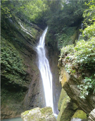
Jiulong (Nine Dragons) Waterfall is located in the left gully of the JiulongxiValley.It is developed in the CambrianChefu Formation (Є3-4c). Lithologically, the stratumismade up of thin layer ofargillaceous banded limestone. The waterfall has a drop ofabout 180m, and anoverflow width of 2-5m. It looks like a silver curtain,with crystal clear water. Below the waterfall is a water pool, which covers an area of about 40m2,and has adepthof about 40cm,with crystal clear water. The waterfallhas a flow of about 3-50L/s,and flows intoJiulong Stream.Yinlian (Silver Chain) Waterfall is anoutlet of anunderground river. Jiupuxi Valley is formed due to structure, and under the joint actions of erosion, dissolutionand bedrock collapse. The underground river moves from higher to lower areas, and is blocked by valley and then exposed to formthe waterfall. |
|
|
62 |
Yudai Waterfall |
Yudai (Jade Spring)Waterfall islocated on the cliffs of the right side of Yuquan Gorge.It is developed on the thin-medium thicklayer of dolomitic limestone and dolomitein the CambrianAoxi Formation (Є3a) and the Aoxi Formation (Є3-4c). The waterfall has a drop of about 200m, an overflow widthof about 4 to 10 m,and aflow rateof 5-20 L/s. With crystal clear water,it lookslike a jade belt pouring down from cliffs. YudaiWaterfall is located in thecore part of the Puibisyncline.Near the waterfall is developed Bake-Xintiantensile faultrunning in the direction ofnortheast.High-angle joints and fissures are very developed in the area. The flowing water iseroded and dissolved along the fissures and fractures, and the collapse of the bedrockcombines toforms cliffs, thenthe stream flowspour down the cliffs to form a waterfall. |
|
|
63 |
JiupuxiWaterfall |
The waterfallconsists of nine cascades, which havea total drop of about 100 meters. The underground river flows out from the TianguotanCave andpours down the cliff wall.Lithologically, the exposedrocks are made up of limestone, mixed with dolomitic limestone andlumpsiliceous limestoneinthe middle-Permian Maokou Formation (P2m). Itbottom ismade up ofSilurian shale, sandyshale,sandstone,siltstone, and quartz sandstone.Topographically, the waterfall is located in the valleyrunning in a direction of north-south. The bottom of the valley has a big drop and many stages, forming many waterfall and water pool landscapes.Within a short-distancein the upper partare formednine waterfalls, hence it is called Jiupuxi (literally meaning Nine Waterfalls) Waterfall. The waterfall is exposed near the boundary between the Permian carbonaterocksand the Silurian sandy shale. The bottom sandy shale is awater-resistant layer. The groundwaterchanges to horizontal movement when it moves to this interface and is exposed on the cliff wall to form a suspended waterfall. |
|
|
64 |
Section of Tillite in Snowball Earth Event in the Neoproterozoic Era |
The sedimentary types oftillite in Nanhua System in Xiangxi region belong to theplatform margin and continental margin transitional type, which are formed in the stageofintracontinental rift clastic rock. Due to the gravity differenceresulted from the continental rift, the ancient glaciers carry rock breccia to the rift basin, forming continental rift-type tensile molasse deposit, including Fulu Formation in preglacial period,Gucheng Formation in lowersub-glacial period, Datangpo Formationin inter-glacial period, and Nantuo Formation in upper sub-glacial period.Sedimentary discontinuitiesgenerally occurbetween different formations of tillitein this area, or there are paleo-weathering crusts, orlaminated quartz veins. Among them, thedepositsof the Nantuo Formationin the uppersub-glacial period are the most complete, with a thickness of more than 600 meters.Gucheng Formation in the lower sub-glacial period andDatangpo Formation in theinterglacial period have a thickness of onlydozens of meters. Fulu Formation in thepreglacial period and Fulu Formation in Qingbaikou period are mostlyinlow-angle unconformity contact. At the top of the tillite are generally developed the thick layer-block cap dolomite underwarm climatic conditions, which is recognized asa sign on the end of the Snowball Earth Event in Nanhua period. |
|
|
65 |
Section of Capped Dolomite in Ediacaran System |
The 30m-long section isdeveloped in the Sinian Doushantuo Formation (Z1d) and the Nanhua NantuoFormation (Nh2n). The cap carbonate rocksinNeoproterozoic era are mainly made up of silicified dolomites,with itsthickness ranging from a few meters to tens of meters.However, the time represented by them is only a few thousand years, which results fromrapid deposition, indicating a suddenclimatechange. The cap carbonate rocks are directly deposited on the Neoproterozoictillite, which best reflects the dramatic changes in the paleoclimate at the end of the Neoproterozoic glacial period, while the carbonate rocks also record changes in the ocean at the end of theSnowball Event. |
|
|
66 |
Section of Oceanic Red Bed inSilurian System in Xiqi |
The sectionis located near the Liulangxi Village,XiqiTownship, Longshan County, with an elevation of 380m. The section is about 50m long. The thickness of asingle layer is 3-10cm, which is called the “lower red layer”,corresponding to the lower part of the Telychian Stage inLlandovery Series,and belonging to the shallow sea phase deposit. The section reflects the palaeogeographic environment of the "red layer"in the upper and lower Silurian system. Due to large amount of fine debris containing high valence Fe carried by theriver water, thesedimentsource ismostlyaccumulated in the near-shore seabed where oxidation occurs. Moreover, at that time the area was experiencing a sea regression,some parts of the seawaterwere desalinated,and the lack of rising ocean currents resulted in poor nutrients and low content oforganic matters. Therefore, fewfossils can be found in this formation. |
|
|
67 |
Section of Oceanic Red Bed inSilurian System inPurong |
The section is about 60m high. Its lowerpart isexposedon thestratum ofthe Silurian Huixingshao Formation (S1h), which is a set of intertidal-subtidal sandy and argillaceous sediments. Lithologically, it is made up of purple red-bluishgreen-greyish green silty mudstone, and interbed ofyellowishgreen and purple redsiltymudstone.Itiscommonly known as “upper red layer”. The middle part mainly consists of gray and green argillaceous sandstone, withahorizontal bedding. Thelower limit of thesection istheappearance ofpurple-red sandy mudstone,while its disappearance is considered the top boundary. The upper partof the section is dominated bythe greyish-yellowmedium layer of fine sandstoneinXiaoxiyu Formation (S2x),with a clear markingboundary. |
|
|
68 |
Section of Oceanic Red Bed inDevonian Systemin Dianfang |
The 200m-long sectionlieson the right bank of theLaoche River.It is exposedin the middle-Devonian Yuntaiguan Formation (D2y), which is a typical coastal terrigenous clastic deposit.Lithologically, it is made up of a medium thicklayer of quartz sandstone mixed with thin layer of silty mudstone. A single layer is 15 ~ 35cm thick.The rocks are fleshy red,and horizontal bedding, obliquebedding,andcross-bedding are commonly seen in the rocks. Therocks inYuntaiguan Formation are hard and difficult tobeweathered, often forming steep ridges, which is thesource for the formation of Zhangjiajie peak forestmade up ofsandstone. |
|
|
69 |
Section of Oceanic Red Bed inSilurian Systemin Luota |
The section is located in the southeast wing of Luota syncline in Longshan County.With a total length of about 400m, the section iscommonly known as the “upper red layer”. It corresponds to the middle and upper parts of the Telychian Stage inLlandovery Series. It is a set of intertidal-subtidalsilty sediments.Lithologically, it ismade up ofpurple red-bluishgreen-greyishgreen,thin-medium thick layer of silty mudstone and interbeds of yellowish-green and purple-red silty mudstone,with an occurrence of 283°∠37°. The strata are exposed intwowings of Luota, Xiangxi. While its northwestern wing isgentle andflat, the southeastern wing is steep. The strata are exposed completely, and the outcrop conditions are good, which can be used for study and comparison. |
|
|
70 |
Sectionof Basal Conglomerate of Lake Faciesin Cretaceous Systemin Zejia |
The25m-longsection is formed in the Yanshanian period. The Yanshan movementplays a decisive role in the evolution of theEarth’scrust during the neoid geological period and the settingof the regional tectonic framework. It began to occur at the end of the Middle Jurassic epoch, and was characterized by strong fault activity, upliftoffault block and slight folds. It can be roughly divided into twoacts. The first act occurred in the early Middle Jurassic epoch, which was marked by the absence of Late Jurassic sediments. The blockconglomerates in the Early Cretaceous Shimen Formation wasinunconformity with the Jurassic and older strata.In the area, the northeastwardnappe structurehas become driftedin large sizeandbecome fixed andunchangeable in the end; the second act occurred in the late Early Cretaceous epoch, which was characterized byfurther movement of fractures at the edge and in the basin. The basinwasgradually closed and slightly folded. The basin and ridge structure became fixed in the area. |
|
|
71 |
Unconformity of Haixi Movement at Luota |
The 600m-long section is an unconformity between the Permian and Silurian systems.Its upper part is exposed in shale, carbonaceous shalemixed withcoalbed in the mid-Permian Liangshan Formation and thick, laminatedlimestone and dolomitic limestone inQixia Formation,andMaokou Formation; while its lower part is exposed inSilurian sandy shale, argillaceous mixed with sandstone. Devonian and Carboniferous strata areabsent between the two parts,showing disconformity or slight-angleunconformity, which is an important evidence for the uplift of the Caledonian and Hercynian tectonic movements. The upper limestone is hard, where vertical joints and fissures are developed. The lower Silurian sandy shale is a kind of soft rock,which suffers from severe weathering, making the upper limestone lose its support. The rock massinclines along the joints and fissures towards the free surface to form a collapse relic. |
|
|
72 |
Shuanglong Karst Platform |
ShuanglongKarstPlatformis exposed in the CambrianAoxi Formation (Є3a),Chefu Formation (Є3-4c) and Bitiao Formation (Є4b). Lithologically, it is made up of thin-thick layer of limestone, dolomitic limestone,and argillaceous banded limestone. The elevation of the platformranges from 800-1000m. Its plane shape isoval,covering an area ofabout 85km2,with a long axis ofabout 12.5km long, anda short axis of 7.5km long.While the east side is a steep cliff, the west side is a deeply-incised gulley.On the platformare developed karst hills, depressions, sinkholes, and dolines. The density of the sinkhole development is 2~3/km2, and thekarsthills are 50-150m high,with around top. The platform is mainly formed by the erosion, dissolution and collapsein the process of Earth crust’s uplift. |
|
|
73 |
Heku Karst Platform |
HekuKarstPlatform isdeveloped in the Ordovician Tongzi Formation (O1t), the Cambrian Loushanguan Formation (Є3-4l), and Bitiao Formation (Є4b).Lithologically, it is made up of gray thick -very thick layer ofcrystalline limestone and dolomite. The platform has an elevation of 680-900m. The plane shape is a long strip,covering an area of about 53km2,which is13.6kmlongand 1.5-8km wide. On theplatformare developed karst hills, depressions, sinkholes, and dolines.Thekarsthills are 50-150m high,with around top. The platform is mainly formed by the erosion, dissolution and collapsein the process of Earth crust’s uplift. |
|
|
74 |
Jiating Karst Platform |
Jiating Karst Platform is exposed inthe CambrianAoxi Formation (Є3a) andChefu Formation (Є3-4c). Lithologically, it is made up of gray thin-medium thick layer of limestone,argillaceous banded limestone, anddolomiticlimestone. On theplatform are developed karst hills, depressions, troughs, sinkholes anddolines. Thekarst hills are generally 20 to 40 m high,with aslope of 25 to 30 degrees; the depressions are mainlyoval and strip-shaped,running in anortheast direction. The platform isoval,covering an area of 3.5km2. Its long axisis 2.7km long and runs northeast,while the short axis is1.6km long,withanelevation of 400-650m. The platform has an elevation of 400-500m. While cliffs are mainly distributed in the northern and western sides of theplatform, steep slopesoccur in thesouthern and eastern sides, with a slope of more than 50° . |
|
|
75 |
Nongche Karst Hill-Peak Cluster |
Nongche PeakCluster-Depression lies at 4km northeast ofDianfang Town, Longshan County.It is developed on the limestone in the Upper-Permian Wujiaping Formation (P3w),and inDaye Formation (T1-2d) and Jialingjiang Formation (T1- 2 j) of the Triassic system. Lithologically, it is made up of thin—thick layer of limestone and dolomitic limestone. The peak cluster contains 17 rock peaks, which are linearly distributed in low-lyingnegative terrains.Each single rock peak is 60m-100m high,with adiameterof70~300m. The entire peak cluster extendsforabout 8km,where mountain vegetationisdeveloped. Xindi PeakCluster-Depression is distributed along the core part of Dianfang syncline in the direction of northeast 30°. Due to theeven dissolution of flowing water, a linearpeak cluster is formed. |
|
|
76 |
Xishaping Polje |
Xishaping Polje lies at the turningpart between thesoutheast wing of Luota syncline and the northwest wing of Hongyanxi-Bi’er anticline.The bottom of thepolje isexposed on the medium-very thick, laminated limestone, dolomitic limestone and dolomite in the lower-Ordovician Tongzi Formation andHonghuayuan Formation. The bottom of thepolje is about 2km long,and100~420m wide,covering an areaof about 0.47km2. The polje hasa long strip shape, with a long axisrunning in the directionof 305°. It has a flat bottom, which covers 558mu of cultivated land, mainly including paddy fields. The west side of the Poljeis a peak cluster composed of clastic rocks.A small stream, which is3~5mlongand 1~2m deep, runs throughthe polje. The water source comes from the reservoirat thenorthwest side,flowing from northwest to southeast.It flows into the sinkhole in the southeast end andis thendrained into Xiche RiverValley. Under the action offlowingwater dissolution, the karst collapseis producedat the initial stage, forming asinkhole. As the dissolution deepens,the sinkhole expands further andbecomesconnected, eventually forming the polje. |
|
|
77 |
Zhijia Polje |
Zhijiapo Polje lies near the core part of Hongyanxi-Bi’er anticline. It isexposedinthe Cambrian Loushanguan Formation (Є3-4l). Lithologically, it is made up of thick layer ofdolomite. Thepolje bottom is about 1.9km long,and80-150m wide,covering an areaof about 0.22km2. The long axisruns in adirectionof 280°- 315°, which is approximately the same as the strata strike. The bottom of thepolje is covered with astratum in theQuaternary system, which is 3~5m thick.A small river, which is 2~6m wide and 3~4m deep, is developedin thepolje. It isaseasonalriver, and the bottom of the riverbedmainly contains gravel and rolling stones.At the southeastern end of thepolje is a karst cave,from whichthe stream flowsinto the underground river and is drainedinto Xiche River Valley.Under the action offlowingwater dissolution, the karst collapseis producedat the initial stage, forming asinkhole. As the dissolution deepens,the sinkhole expands further andbecomesconnected, eventually forming the polje. |
|
|
78 |
Xiwu Polje |
Xiwu Polje lies in thecore part ofHongyanxi-Bi’er anticline.It isexposedinthe Cambrian Loushanguan Formation (Є3-4l). Lithologically, it is made up of thick layer of dolomite. The bottomof the poljeis about 2km long,and100-400m wide,covering an area of about 0.5km2 . Its long axisruns in a direction of275°. On the east side is the peak cluster and karst hill containingOrdovician carbonate rocks,which are40-70m high.A small river is developed in thepolje, which flows from west to east.Water channel has been built to divert flood during flood season.Tthreesinkholes aredistributed in thepolje. During the floodseason,aswater cannotbe discharged in time, waterlogging is often formed in the lower reaches of thepolje, and the groundwater finally flows into Xiche River. |
|
|
79 |
Lianhua Cave |
Lianhua (Lotus) Caveisdeveloped in the Middle Permian Maokou Formation (P2m).Lithologically, it ismade up of chert banded limestone, limestone, dolomitic limestone. The rock joints and fissures are relatively developed. The entrance to the cave is 2.4m high and 2.3m wide.Twosub-cavesare developedinside, whichare in the shape of herringbone.Inside it the cave is 2.5m wide, 4.0m high,and26m deep. A small amount of stalactites and stalagmites are developed in the cave. Thelargest stalactite is 1.1m long and the lower stalagmite is 1.2m high. A small amount of chemical depositsaredeveloped at the bottom. The cave is formed by the erosion and dissolution of water along the fissures. |
|
|
80 |
Wuyan Cave |
Wuyan (Eave) Cave is developed in the middle-Permian Qixia Formation (P2q ). Lithologically, it is made up of keloid crystalline bioclastic limestone.The entrance to the cave is 46m high, and 26m wide, turning to 70-80° after 50m. The cave is more than 819m deep.The cave has an average width of 10-20m, ranging from 5m to 37m. The cave has an average height of 30-50m, ranging from 10m to 65m. The longitudinal section in the cave is divided into three stages: upper, middle and lower parts. The two cliffs in the lower cave are stiff, which are used to discharge water.The middle cave has a width of more than 10m at the bottom, and a height of 10-15m. The two walls are uneven, and sub-caves are developed.The upper cave has a width of 10-25m at the bottom, and the two walls are uneven, and small sub-caves are developed. Many karst pools and step-down floors are distributed in the cave.The step-down floor is 5-6m high, while the pool is 1-7m deep.There are seven large karst pools, which are generally 20m long, 15m wide and 4m deep.The longest one can reach 120m and the deepest one can be 6-7m. In some parts of the cave are developed various speleothems, such as stalagmite, stone curtain, stalactite, stone ridge and tufa.At the entrance to the cave the faults running in the direction of north-northeast and northwest intersect.The cave body is mainly developed along the faults running in the direction of north-northeast.The cave is formed by the erosion and dissolution of flowing water along the north-northeast fractures, and collapse of the rocks.
|
|
|
81 |
Tianguotan Cave |
The karst cave is developedin the Middle Permian Maokou Formation (P2m).Lithologically, it is made up of very thick layer of limestone and dolomitic limestone. The cave is 38m high and 15~20m wide, leading to theRuishi Villageatthemountainback. At the entrance of the cave a large number of falling rocks formed by collapse can be found. The maximum size is 8×6×6m3. The jointsand fissures of rock, as well as many small caves are developed. The cave runs in a direction of 320°. The cavesturns narrow when visitors enter60m inside the cave. A fracture can be seen in the cave, which is arc shaped. The fracture zone is 1.5~2m wide, whose direction is essentially consistent with that of the cave.. The stalactites and stalagmites are notwell developed in the cave. The cave is formed by the erosion and dissolution of ground water along the fault, and collapse of the rocks.
|
|
|
82 |
Yuechuanyan (light through cave) |
Yuechuanyan (Moonlight Penetrating through Rock) Light through Caveisdeveloped inthe Qingxudong Formation (Є2q), the Second Series ofCambrian system. Lithologically, it is made up of thin-medium thick layer of dolomite and dolomitic limestone. Thecave looks like a crescentmoon, henceit isnamed "Yuechuanyan (literally meaningmoonlight penetrating through rock)". The light through cave occurs at the end of rock wall running in the direction of northwest,whichfaces NE63°,and isconsistent with the strike of the passive rock wall- rockpillar group. The light through hole is 3-5m wide, 8-10m high and 5m deep. In the early stage,a karst cave was formed by the erosion anddissolution of the flowing water. In the later stage, in the process of Earth crust’suplift, theroofof the cave collapsed and partially remained in the original place,thusformingthe lightthroughcave. |
|
|
83 |
Xichehe Valley |
Xichehe (Xiche River) Valley is developedin the OrdovicianHonghuayuan Formation (O1h), Tongzi Formation (O1t), and CambrianLoushanguan Formation (Є3-4l).Lithologically, it ismade up ofdark gray medium-thick layer of crystalline bioclastic limestone, light gray thick-verythick layer of crystalline limestone,andthick-blocky dolomite. Thevalley is about 6.2km long, running in a directionof southwest.It is V-shaped. The valley is 50-80m wide at the bottom,and80-120m deep. At the bottom isXiche River,whose river bed is 10-38m wide. Themountain massifson both sides of thevalley are steep. Due to theimpact of the fault of Xiche River,karstcaves and folds are developed on both sides of the valley.The overallstrike of the valley is consistent withthat ofthe Hongyanxi-Bi’eranticline axial trace. |
|
|
84 |
Mengxi River Valley |
Mengxi River Valley is developed inthe Permian (P) and Silurian (S) strata, and thevalley runs mainlyin a direction ofnorth-northeast. It is about 3km long, and 10-30m wide at the bottom. The cross section is "V" shaped and 200-500m deep.Both sidesof the valleyare steep,although there aresomedifferences.The east side is steep, with an average slopeof 30-50°.In some parts the slope islarger than 50°. The upper part of the west side is a continuous karst cliff wall, which is150-260m high. The cliff wall is nearlyupright, with a slope of 30-50° from the cliff to the valley. Cliff walls are mainly developed about 700m on the west side of the northern part of the valley.The cliffs are mainly fault-based cliffs, where the tectonic traces such as scratches, steps,secondary fractures and joints can be found.At early stage, the river valley was subject to the erosion, and dissolution of flowing water along fractures; while in the later stage, it was mainly affected by erosion and washing of water after it had penetrated through the limestone layer.
|
|
|
85 |
Naxilao Valley |
Two sides of the valley are exposed in the Permian system. Lithologically, the valley is made up of siliceous banded limestone, limestone, calcite dolomite and dolomitic limestone.The valley is 20-50m wide at the bottom, 300-600m wide at the upper part, 2.4km long and 260m deep. It is V-shaped, running in a direction of65-245°.The upper part on the right side of the valley isdominated by farmlands,with aslope is gentle,with a gradient of40-80‰; the slopeareason both sideshave a slope of 50-60°,wherevegetation is developed, and a large amount of debris flow depositscan be found in the upper part of the valley. Thevalley is formed by the fault structure and rain erosion anddissolution. |
|
|
86 |
Diaoshuikan Waterfall |
Diaoshuikan Waterfall lies in Wutai Village, Luota Township. It is developed on the strata in the middle-Permian Maokou Formation (P2m). Lithologically, the strata are made up of bioclastic limestone, dolomitic limestone,andargillaceous limestone.Structurally, it is located in the southeast wing of northeast syncline,where fracture structureisdeveloped,mainly running in a direction of north-east and northwest.Diaoshuikan Waterfall is a fault running in a direction of northeast, and the steep slope of the waterfall is a fault cliff. The waterfall has a drop of 75m and a width of 2~3m. Itpours down and is about 5m wide. The water sourcecomes from the valley water, which is a perennial waterfall.During the rainy season, the waterfallhas a large water volume and offers aspectacular view. The surface water is erodedand dissolvedalong the fault, and the collapse of the bedrock itselfhelpsform a cliff wall, and then the stream falls down the steep cliff to form a waterfall. |
|
|
87 |
Atalao Waterfall |
AtalaoWaterfalllies in Lieba Village, Luota Township.It is exposed on the stratain Silurian system. Lithologically, the strata are made up of sandstone, siltstone,andargillaceous siltstone, etc., with a flat and gentle occurrence. In terms of structure, it is located at southwesternbackup end ofthe northeastward syncline,where fault structureisdeveloped, mainlyrunning in a direction ofnortheast and northwest. The waterfall has a drop of 58m and an overflow width of 1 to 3m. It is a perennial waterfall with a large water flow, offeringa beautiful landscape. The site is a northwestward fracture,alongwhich a high steep ridge is formed. The groundwater is drained into thegulley and merged into a stream, which is blocked bythe steepridge to pour down andform a magnificent waterfall. |
|
|
88 |
Jidu Waterfall |
The waterfall is located at the source of the Jipoling Valley, with a drop of about 40m and currentoverflow width of 2m.During the rainy season, the flow increases. The waterfalllooks like a light yarn, with a flow rate of about 10L/S. The lower part is a water pool, which has a square shape,an area of about 600m2 and a depth of 3m. The waterfall flows to the Shuitian River, which is sourced from a spring water in Dashuijing Village. The waterfall isdeveloped in the CambrianAoxi Formation (Є3a). Lithologically, it is made up of thin-medium thick layer of dolomitic limestonemixedwith marl. Karstis poorly developed in the area, andoverland flowsare formed, and result in the waterfall at the edge of the valley. |
|
|
89 |
Baxiandong Heavenly Lake |
Baxiandong Reservoirlies in the northwest side of Luota Township, Longshan County.It is developed on the strata in the Middle Permian Maokou Formation (P2 m).Lithologically, the strata arecomposed ofbanded dolomitic limestone containing chert nodules.Around the reservoirlayer upon layer of mountainscan be seen, and the vegetation is flourishing.Footpathsand observation decks are built around the reservoir. Baxiandong Heavenly Lake is a dissolved reservoirat the lower reaches of the Yanzi Cave underground river. The bottom of the depression has an elevation of 1055m, the normal water level is designed to be 1085m. Ingeneral, thewater storage depth is about 25m, with a maximum water storage depthof 30m. The corresponding water storage capacity isestimated to be400,000 cubic meters.Theinlet of the underground river on the south side of the depression is intercepted,and two blocking bodies are built to store water by using the karst depressions at the upper reaches. Many caves are developed around the reservoir. The diameter of the caveranges from 2m-15m. One of them is called Baxian Cave (literally meaningEight Immortals Cave), which runs in a direction of north –south. The caveis 25m long, 14.5mwideand 3.7m high. |
|
|
90 |
Liziping Landslide |
TheLandslideisdevelopedin the Third Series of CambrianAoxi Formation (Є3a). Lithologically, it is made up of thin layer of powdered crystalline dolomite, and dolomitic limestonemixed with dolomitic shale. The plane of the landslide is in a reversed-"U" shape.It has a longitudinal slopelengthof about 51m,awidthof about 42m,and a height differenceof 31.5m,and a body depth of4.4~15.64m. Covering an area of about 1500m2, its volumeof the landslideis about 1.2×10⁴m3, running in a direction of about 100°. It is a small,shallow andtractive landslide of residual slope. The sliding body soil is mainly composed of residual slope red clay, containing 10-20% of strong-middle weathered rock fragments, and the sliding bedmainly consists ofstrongly weathered dolomite. A solution of “anchor lattice beam + intercepting drainage ditch” has been adopted,allowing landslideto becurrently in a stable state. |
|

