MAIN GEOLOGICAL HIGHLIGHT AND OTHER ELEMENTS
1. GSSP in the Cambrian System
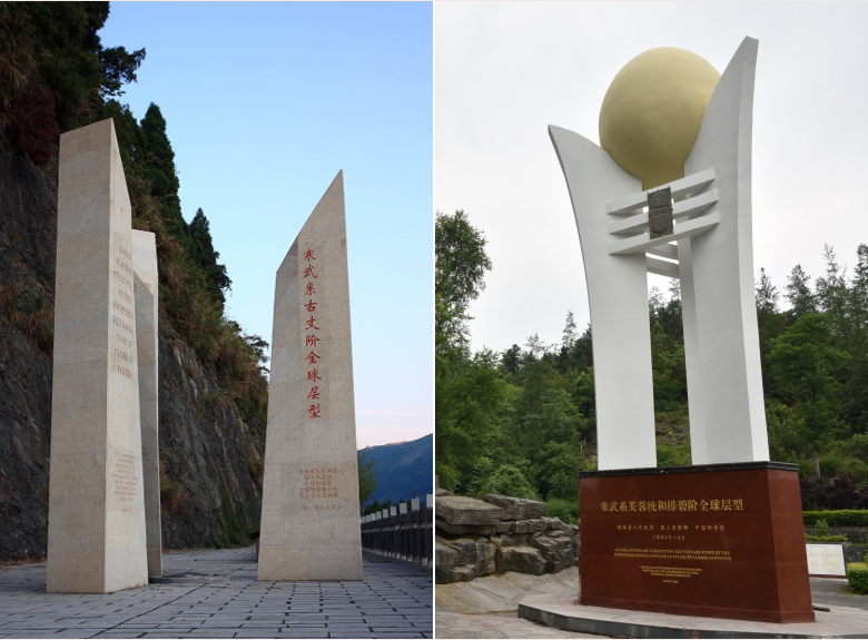
The Cambrian strata in Paibi Township of Huayuan County and Luoyixi Town of Guzhang County within the geopark belong to sedimentary slope zone of Paleo-Yangtze Platform, as well as the mixed Paleontological zone transitioning from shallow seas to deep ones. The Paibi-Guzhang Section, developed in the special geological settings, is characterized by single rock facies, complete strata, continuous outcrops, obvious boundary lines, and rich fossils. The standard fossils and key molecules in the “Agnostida ” fossil zone of the Section have great significance in comparing with other international strata in the Cambrian system. The Section is also considered as the best one for defining series and establishing stages for the Cambrian system worldwide.
In February 2003, one of the first Standard Global Chronstratigraphic Units in the Cambrian system, or the Paibian Stage in Furong Series, was approved by IUGS. In March 2008, the Guzhangian Stage section in the Cambrian system became an international standard stratotype. The two GSSPs have successfully solved the problem of accurately defining the strata in the Cambrian system all over the world, and, therefore, have great significance in comparing international strata.

The two GSSPs in Guzhang Stage and Paibian Stage
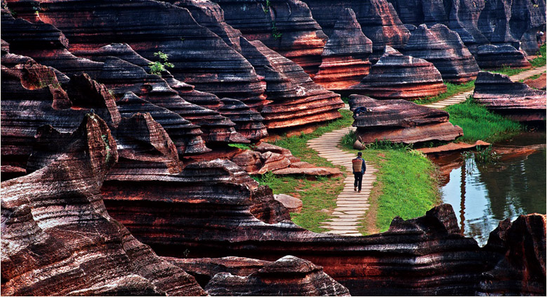
2. The World’s Largest Red Stone Forest Landscape
The purplish red, nodular marlite, muddy limestone and marlite that are deposited in platform -shoal facies of mid-Ordovician Series in the geopark show a special and exceptionally rare oxidized sedimentary environment, and have a very great global significance. The Red Stone Forest is a rare type of karst landscape developed on this stratum. It mainly occurs in the valley slope zones with an altitude of 300-550m along the two banks of Youshui River and its tributaries. Under the long-term dissolution and weathering of groundwater and atmospheric precipitation, the sub-soil differential dissolution changes to surface differential weathering, which helps shape more than 1,000 red stone pillars each with a height of 10-30m, featuring various forms, distinct levels, diverse types and complex combinations. Covering a total outcrop area of 84 km2, the Red Stone Forest is recognized as the world’s largest red stone forest landscape developed on the red carbonate strata in the Ordovician system. As a key part for the evolution of South China Karst, it is a karst geosite with outstanding scientific value and global significance in Xiangxi Geopark.

The Largest Red Stone Forest
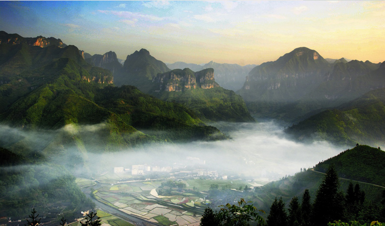
3. Spectacular Karst Platform-Canyon Landscape
Since Paleogene Period, large areas in Xiangxi were subject to large-scale denudation and planation processes, and two levels of denudation-planation surface were developed in Luota Age(1,000-1,400m) and Zhaoshi Age(600-900m). Due to the impact of Neotectonic Movement, the Xiangxi area rapidly rose and the syncline was turned into mountains. The ancient Youshui and Wushui water systems eroded and incised the substrates along the edge of the Yunnan-Guizhou Karst Plateau, thus forming the Luota-Lüdongshan-Dehang Karst Platform-Canyon Group. These canyon groups are mixed with the cracked karst platforms, and are known as the world’s largest vein mesh-shaped canyon groups that are most densely developed on kart plateau. They are an exceptionally rare canyon landscape in the world for their large scale and quantity and magnificence.
In the geopark, the surface and underground hydrological and geomorphological systems co-evolved, featuring diverse geomorphological combinations of platform-canyon-rock pillar-rock wall-waterfall-cave. The residual karst platforms, multi-level planation surfaces and subterranean stream cave systems completely record the geologic history of the rapid uplift of the earth’s crust since the Neotectonic Movement in the Cenozoic Era, representing the evolution processes of corrosion, incision, separation and disintegration of slopes in the fringe areas of Yunnan-Guizhou Plateau.

TIanxingshan canyon
4. Integration of Karst Geologic Ecology and Ethnic Minority’s Culture
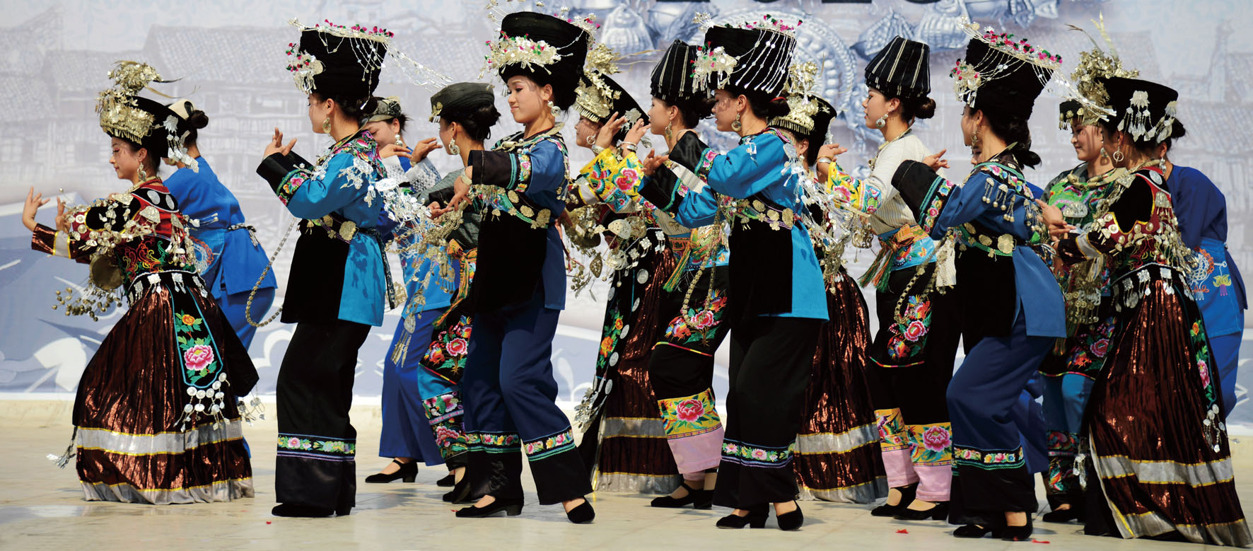
The geopark is characterized by humid climate, deeply-incised canyons and difficult access. Over the past years, various ethnic groups have formed different styles and types of ethnic cultures. The ethnic minorities’ villages, as the best carrier of ethnic minority’s culture in the geopark, are fully shown to the public through tangible folk customs(e.g., buildings, structures, traditional arts and crafts, clothing, living and food), and intangible folk customs (i.e., rites, traditional holidays, religion, music and dance). The geopark is famous for its folk customs that have been passed down from generation to generation, diverse ethnic arts, unique ethnic clothing and food: myths and legends (ancient myths of Miao ethnic minority), witch culture and traditional opera (tea-picking song-dance, and Miao song), fishing and hunting culture (waving dance, climbing a ladder of knives), festive culture (Miao’s traditional songs and dances, bride crying song), costume culture (Tujia brocade, wax printing of Miao), and food culture (pickled fish and sausage), etc. These cultures are closely associated with the local complex geological structure, intermixing of gorges and cliffs, humid and rainy climate, as well as the favorable karst ecological conditions.
The long history, rich cultural resources, simple folk custom and natural beauty in the geopark combine to create a beautiful, harmonious and natural ecological environment. A unique and mysterious ethnic groups’ ecological cultural landscape in karst mountainous areas is thus formed, which perfectly integrates the pristine natural environment with local ethnic groups’ culture, and has attracted many tourists from China and beyond.

Costume of Miao Minority


